MyTopo
Roseburg Michigan US Topo Map
Couldn't load pickup availability
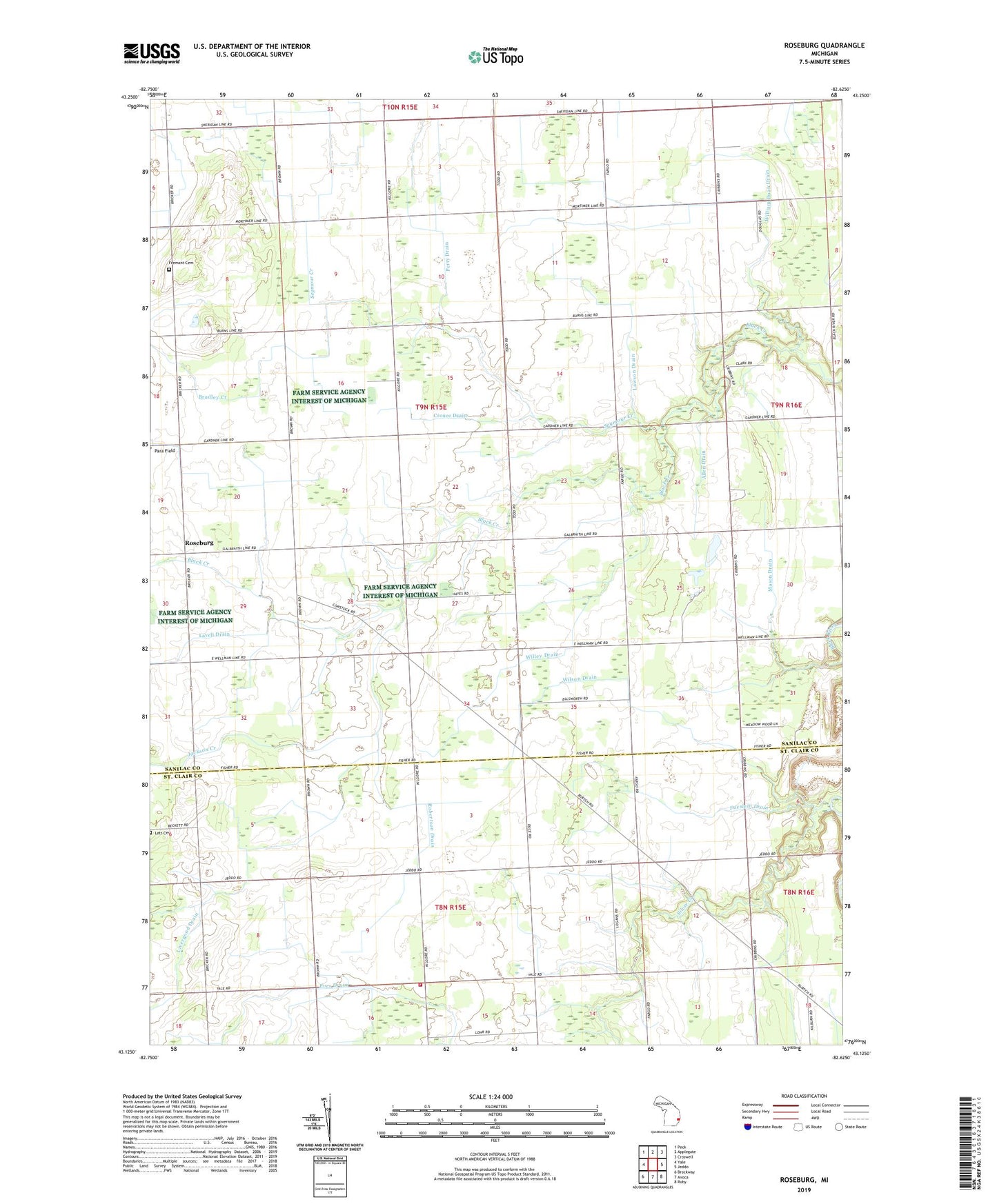
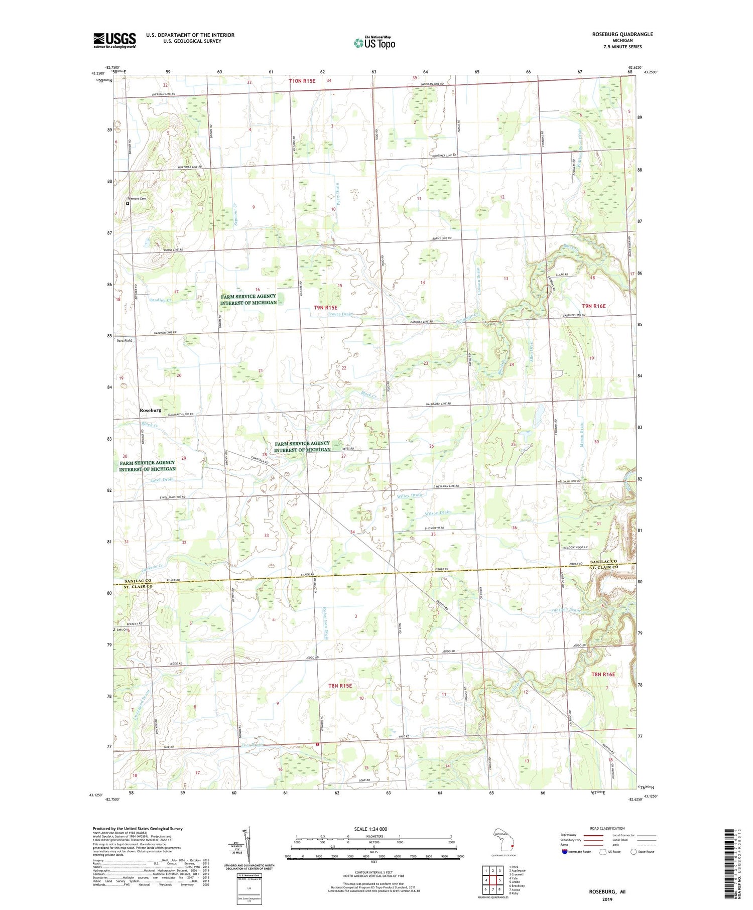
2019 topographic map quadrangle Roseburg in the state of Michigan. Scale: 1:24000. Based on the newly updated USGS 7.5' US Topo map series, this map is in the following counties: Sanilac, St. Clair. The map contains contour data, water features, and other items you are used to seeing on USGS maps, but also has updated roads and other features. This is the next generation of topographic maps. Printed on high-quality waterproof paper with UV fade-resistant inks.
Quads adjacent to this one:
West: Yale
Northwest: Peck
North: Applegate
Northeast: Croswell
East: Jeddo
Southeast: Ruby
South: Avoca
Southwest: Brockway
Contains the following named places: Allen Drain, Bethel Missionary Church, Black Creek School, Bradley Creek, Burns School, Crouce Drain, East Fremont Post Office, East Greenwood Post Office, Fremont Cemetery, Fueslein Drain, Greenwood Church, Hunt Drain, Jackson Creek, Kenockee Township Fire Department Station 2, Lavell Drain, Lawson Drain, Lett Cemetery, Livergood Drain, Mason Drain, McIntyre and Willing Drain, Mitchell School, Perry Drain, Red School, Robertson Drain, Roseburg, Roseburg Post Office, Roseburg School, Seymour Creek, Silver Creek, Silver Trails Camp, Teets School, Thorley School, Township of Fremont, Willey Drain, William Doan Drain, Wilson Drain