MyTopo
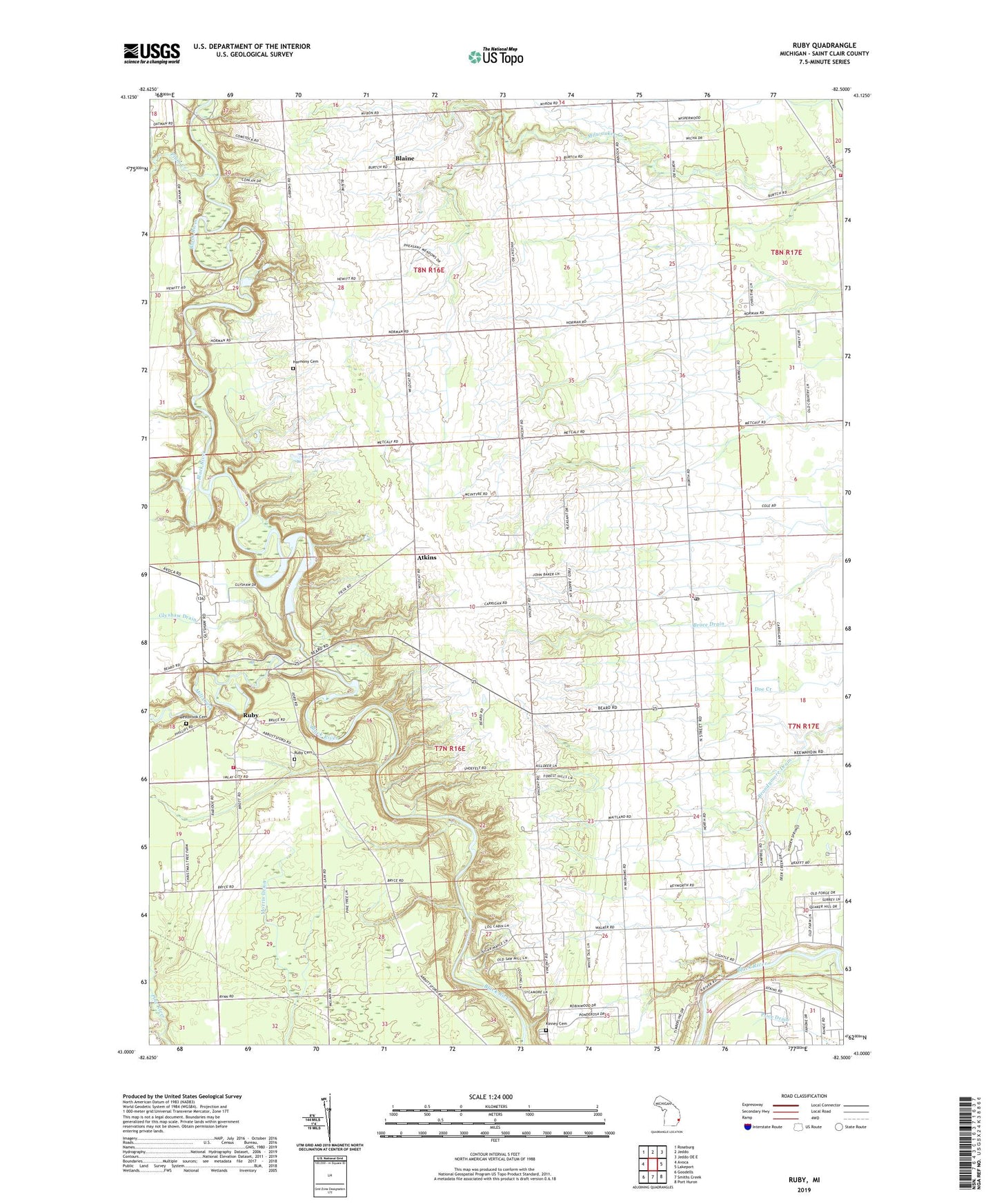
Ruby Michigan US Topo Map
Couldn't load pickup availability
2023 topographic map quadrangle Ruby in the state of Michigan. Scale: 1:24000. Based on the newly updated USGS 7.5' US Topo map series, this map is in the following counties: St. Clair. The map contains contour data, water features, and other items you are used to seeing on USGS maps, but also has updated roads and other features. This is the next generation of topographic maps. Printed on high-quality waterproof paper with UV fade-resistant inks.
Quads adjacent to this one:
West: Avoca
Northwest: Roseburg
North: Jeddo
Northeast: Jeddo OE E
East: Lakeport
Southeast: Port Huron
South: Smiths Creek
Southwest: Goodells
This map covers the same area as the classic USGS quad with code o43082a5.
Contains the following named places: Atkins, Atkins Post Office, Atkins Station, Blaine, Blaine Post Office, Blaine Station, BPS Heliport, Brace Drain, Brandymore Drain, Burtchville Township Fire Department, Central Church, Clyde Township Fire Department, Glyshaw Drain, Harmony Cemetery, Kinney Cemetery, Mill Creek, North Street, North Street Baptist Church, North Street Church, North Street Post Office, North Street Station, O'Dette Drain, O'Loughlin Drain, Plum Creek, Red School, Ruby, Ruby Cemetery, Ruby Census Designated Place, Ruby Post Office, Township of Burtchville, Township of Clyde, Township of Grant, Vincent Post Office, Vincent School, Westbrook Cemetery, Zion Post Office, Zion Station, ZIP Code: 48049