MyTopo
Avoca Michigan US Topo Map
Couldn't load pickup availability
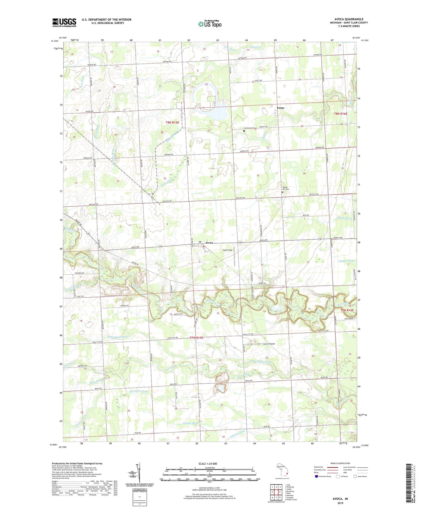
2023 topographic map quadrangle Avoca in the state of Michigan. Scale: 1:24000. Based on the newly updated USGS 7.5' US Topo map series, this map is in the following counties: St. Clair. The map contains contour data, water features, and other items you are used to seeing on USGS maps, but also has updated roads and other features. This is the next generation of topographic maps. Printed on high-quality waterproof paper with UV fade-resistant inks.
Quads adjacent to this one:
West: Brockway
Northwest: Yale
North: Roseburg
Northeast: Jeddo
East: Ruby
Southeast: Smiths Creek
South: Goodells
Southwest: Memphis
This map covers the same area as the classic USGS quad with code o43082a6.
Contains the following named places: Abbottsford, Abbottsford Post Office, Abbottsford Station, Avoca, Avoca Airport, Avoca Post Office, Avoca Station, Emmett Drain, Engles Drain, Eves Drain, Fargo, Fargo Post Office, Fasel Field, Gleason Drain, Greenwood Cemetery, Hayes Drain, Hyde Drain, Jackson Drain, Kenockee Post Office, Kenockee Township Fire Department Station 1, Lindsay Drain, Pohly Drain, Port Huron State Game Area, Quakenbush Drain, Spring Hill Cemetery, Swamp School, Tackaberry Airport, Township of Greenwood, Township of Kenockee, White Drain, ZIP Code: 48006