MyTopo
Brockway Michigan US Topo Map
Couldn't load pickup availability
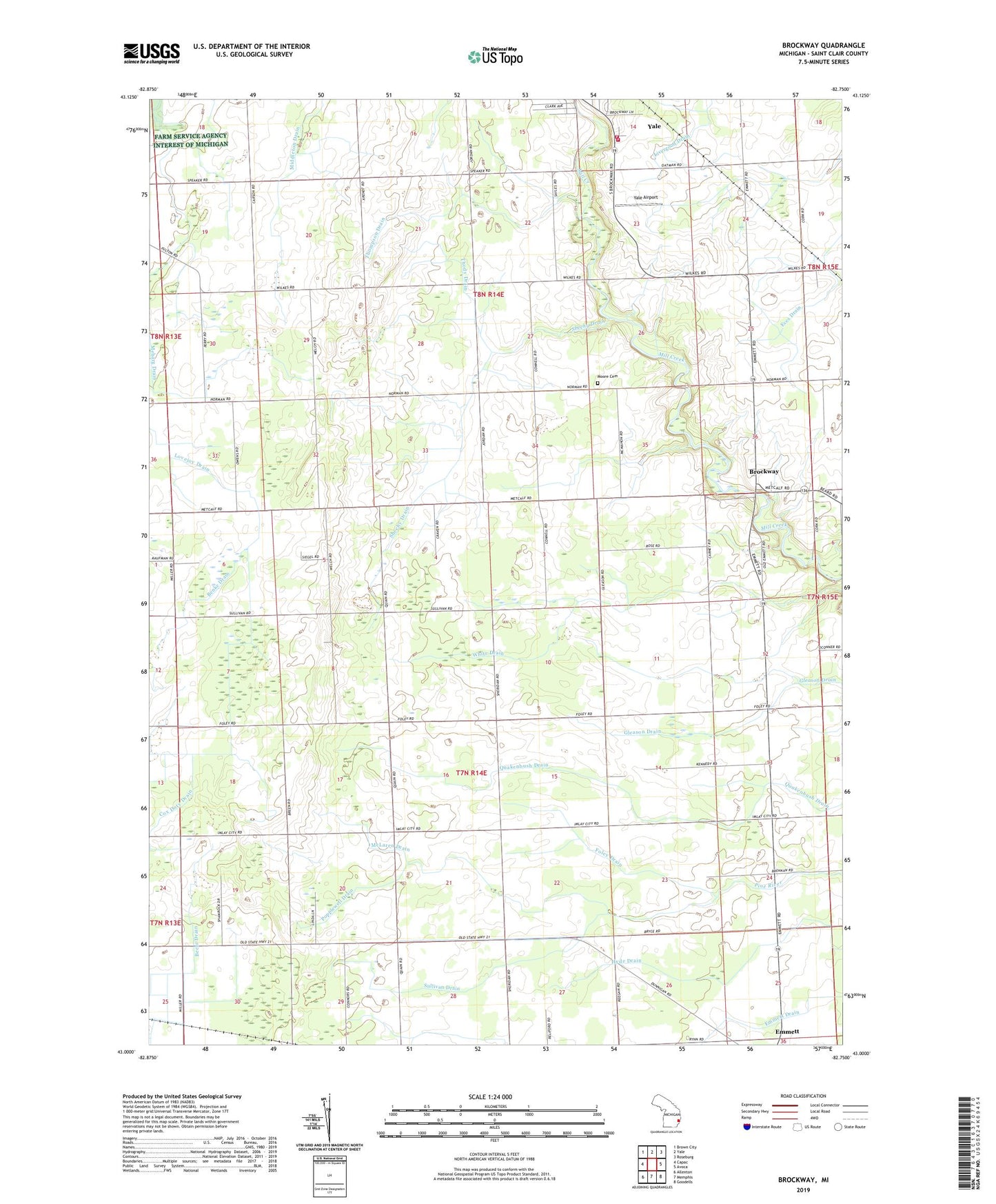
2023 topographic map quadrangle Brockway in the state of Michigan. Scale: 1:24000. Based on the newly updated USGS 7.5' US Topo map series, this map is in the following counties: St. Clair. The map contains contour data, water features, and other items you are used to seeing on USGS maps, but also has updated roads and other features. This is the next generation of topographic maps. Printed on high-quality waterproof paper with UV fade-resistant inks.
Quads adjacent to this one:
West: Capac
Northwest: Brown City
North: Yale
Northeast: Roseburg
East: Avoca
Southeast: Goodells
South: Memphis
Southwest: Allenton
This map covers the same area as the classic USGS quad with code o43082a7.
Contains the following named places: Beehr Drain, Benke Drain, Brockway, Brockway Post Office, Brockway Township Fire Department, Brockway Township Fire Station One, Cole Church, Cole United Methodist Church Historical Marker, Community Gospel Chapel, Family First Health Care Clinic, Foley Drain, Greater Yale Medical Clinic, Lovejoy Drain, McLaren Drain, Middleton Drain, Moore Cemetery, Popplewell Drain, Sheehy Drain, Sullivan Drain, Thody Drain, Thompson Drain, Township of Brockway, Township of Emmett, Tri - Hospital Emergency Medical Services Station 6, Yale Airport, Yale Fire Department, ZIP Codes: 48022, 48097