MyTopo
Ruth Michigan US Topo Map
Couldn't load pickup availability
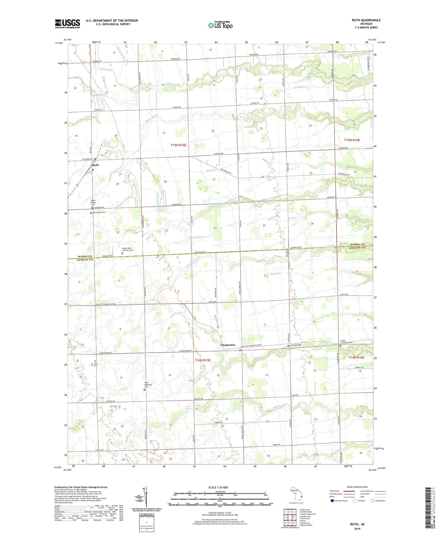
2019 topographic map quadrangle Ruth in the state of Michigan. Scale: 1:24000. Based on the newly updated USGS 7.5' US Topo map series, this map is in the following counties: Sanilac, Huron. The map contains contour data, water features, and other items you are used to seeing on USGS maps, but also has updated roads and other features. This is the next generation of topographic maps. Printed on high-quality waterproof paper with UV fade-resistant inks.
Quads adjacent to this one:
West: Minden City
Northwest: Bad Axe SE
North: Harbor Beach
Northeast: Harbor Beach OE E
East: Forestville
Southeast: Richmondville
South: Deckerville
Southwest: Palms
Contains the following named places: Charleston, Charleston Post Office, Delaware Township Fire Department, Gentner Drain, Immanuel Cemetery, Jim Morgan Field, Kelly School, Linwood Cemetery, Linwood School, Ruth, Ruth Post Office, Ruth School, Ruth Station, Saint Peter and Paul Church, Saints Peter and Paul Cemetery, Schenkel Field, Sherman School, Sherman Township Fire Department, Tamarack Drain, Township of Delaware, Township of Sherman, Trinity Church, Trinity Lutheran Cemetery, Vogel Estates Cemetery, West Delaware Cemetery