MyTopo
Palms Michigan US Topo Map
Couldn't load pickup availability
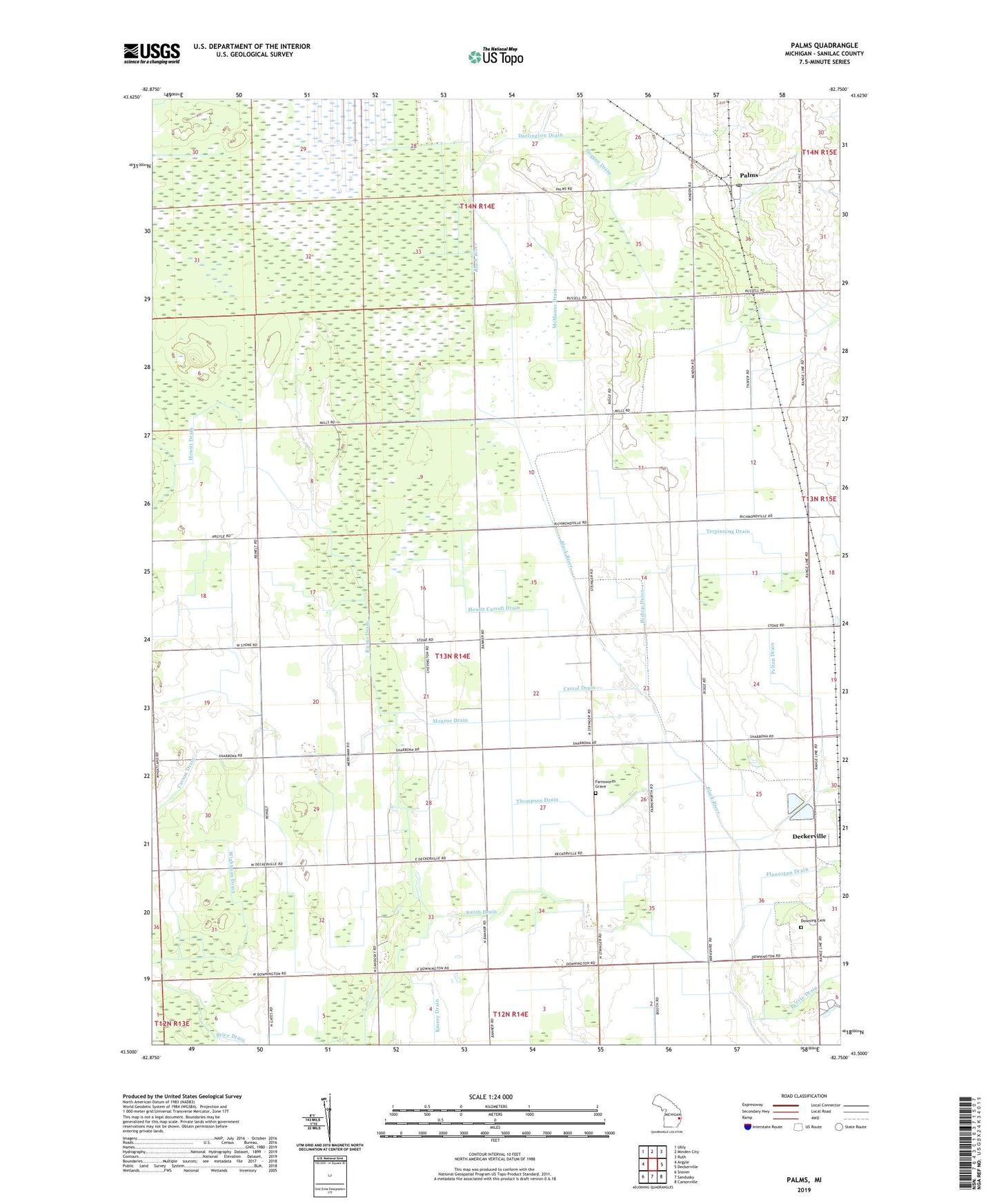
2023 topographic map quadrangle Palms in the state of Michigan. Scale: 1:24000. Based on the newly updated USGS 7.5' US Topo map series, this map is in the following counties: Sanilac. The map contains contour data, water features, and other items you are used to seeing on USGS maps, but also has updated roads and other features. This is the next generation of topographic maps. Printed on high-quality waterproof paper with UV fade-resistant inks.
Quads adjacent to this one:
West: Argyle
Northwest: Ubly
North: Minden City
Northeast: Ruth
East: Deckerville
Southeast: Carsonville
South: Sandusky
Southwest: Snover
This map covers the same area as the classic USGS quad with code o43082e7.
Contains the following named places: Banner Post Office, Bishop Drain, Brice Drain, Carrol Drain, Cedardale Post Office, Chevington Post Office, Deckerville Station, Doggan Drain, Downing Cemetery, Farnsworth Grave, Flannigan Drain, Hewitt Carroll Drain, Hewitt Drain, McManus Drain, Minden City State Game Area, Monroe Drain, Palms, Palms Post Office, Palms Station, Pelton Drain, Pyette Drain, Richie Drain, Sandusky Jehovah's Witnesses, Smith Drain, Terpinning Drain, Thompson Drain, Township of Wheatland, Wheatland Church, Wightman Drain