MyTopo
Sand River Michigan US Topo Map
Couldn't load pickup availability
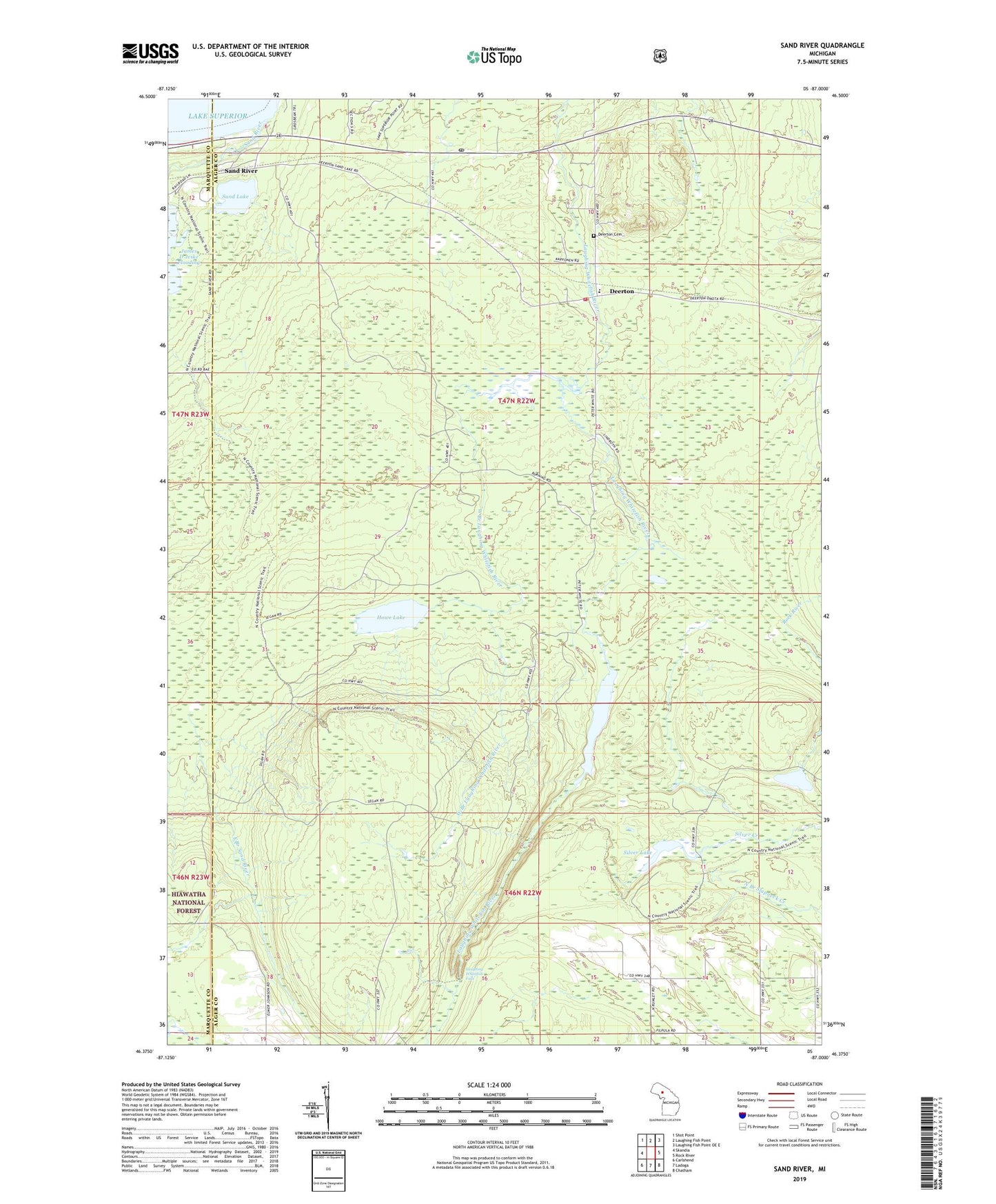
2019 topographic map quadrangle Sand River in the state of Michigan. Scale: 1:24000. Based on the newly updated USGS 7.5' US Topo map series, this map is in the following counties: Alger, Marquette. The map contains contour data, water features, and other items you are used to seeing on USGS maps, but also has updated roads and other features. This is the next generation of topographic maps. Printed on high-quality waterproof paper with UV fade-resistant inks.
Quads adjacent to this one:
West: Skandia
Northwest: Shot Point
North: Laughing Fish Point
Northeast: Laughing Fish Point OE E
East: Rock River
Southeast: Chatham
South: Ladoga
Southwest: Carlshend
Contains the following named places: Au Train-Onota Public Schools, Deerton, Deerton Cemetery, Deerton Post Office, Deerton Station, Howe Lake, James D Jeske Flooding, Laughing Whitefish Falls, Laughing Whitefish Falls Scenic Site, Laughing Whitefish Lake, Onota Township Volunteer Fire Department, Sand Lake, Sand River, Sand River Post Office, Sand River Station, Silver Lake, Tyoga Post Office, Tyoga Station, West Branch Laughing Whitefish River, ZIP Code: 49822