MyTopo
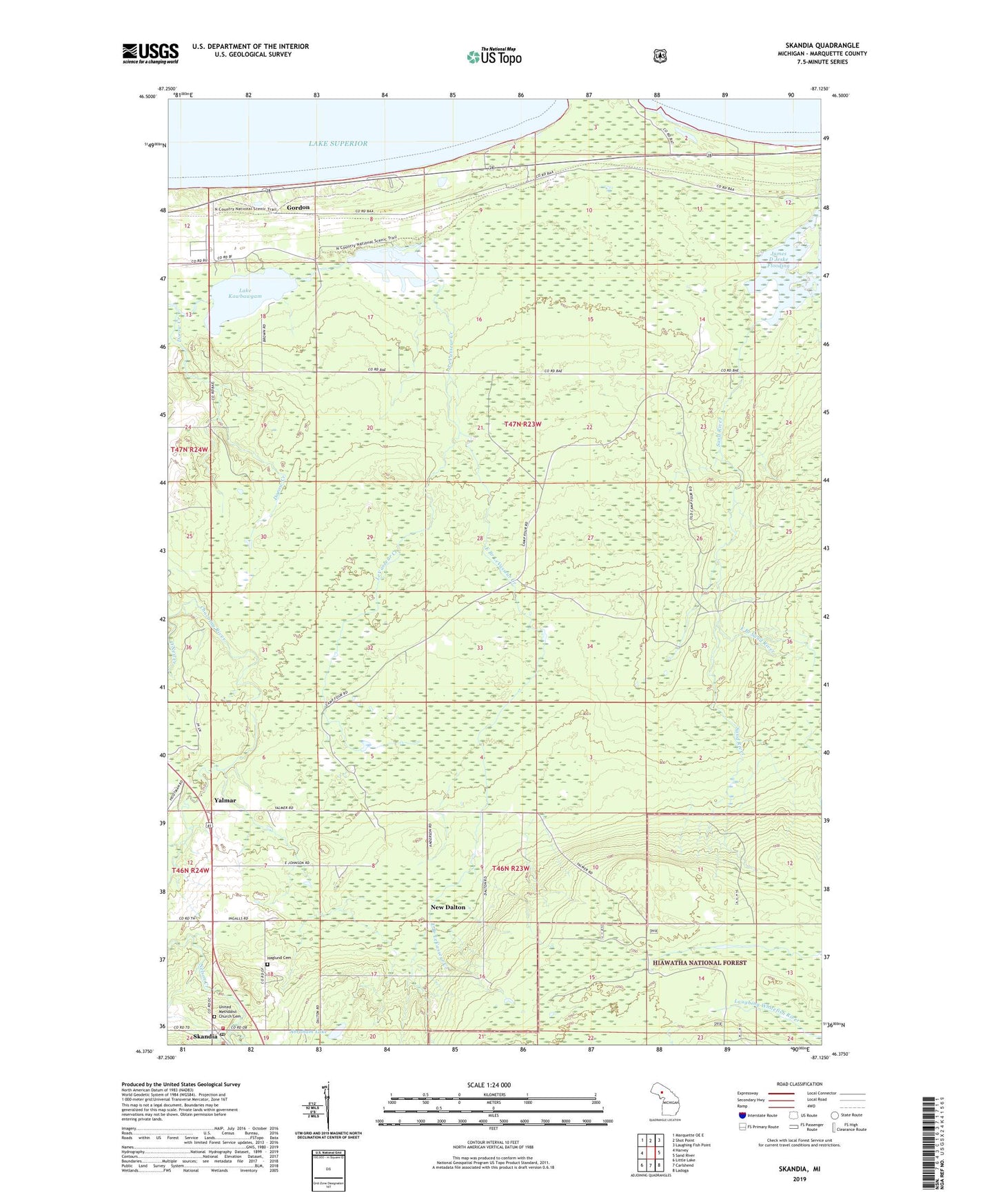
Skandia Michigan US Topo Map
Couldn't load pickup availability
Also explore the Skandia Forest Service Topo of this same quad for updated USFS data
2023 topographic map quadrangle Skandia in the state of Michigan. Scale: 1:24000. Based on the newly updated USGS 7.5' US Topo map series, this map is in the following counties: Marquette. The map contains contour data, water features, and other items you are used to seeing on USGS maps, but also has updated roads and other features. This is the next generation of topographic maps. Printed on high-quality waterproof paper with UV fade-resistant inks.
Quads adjacent to this one:
West: Harvey
Northwest: Marquette OE E
North: Shot Point
Northeast: Laughing Fish Point
East: Sand River
Southeast: Ladoga
South: Carlshend
Southwest: Little Lake
This map covers the same area as the classic USGS quad with code o46087d2.
Contains the following named places: Abraham Lake, Charter Township of Chocolay, Country Chapel, Dorow Creek, East Branch LeVasseur Creek, East Branch Sand River, Gitche Gumee Campground and RV Park, Gordon, Gordon Dam, Haglund Cemetery, James D Jeske Flooding, Lake Kawbawgam, Lake LeVasseur, New Dalton, New Dalton Post Office, New Dalton Station, Skandia, Skandia Emergency Services, Skandia Post Office, Skandia Station, Skandia United Methodist Church, Two Sisters Creek, United Methodist Church Cemetery, West Branch Nelson Creek, Yalmar, Yalmar Post Office, Yalmar Station