MyTopo
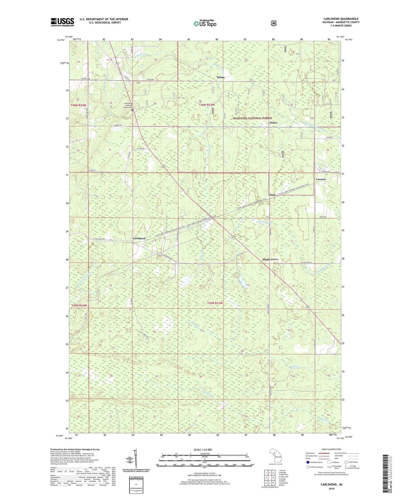
Carlshend Michigan US Topo Map
Couldn't load pickup availability
Also explore the Carlshend Forest Service Topo of this same quad for updated USFS data
2023 topographic map quadrangle Carlshend in the state of Michigan. Scale: 1:24000. Based on the newly updated USGS 7.5' US Topo map series, this map is in the following counties: Marquette. The map contains contour data, water features, and other items you are used to seeing on USGS maps, but also has updated roads and other features. This is the next generation of topographic maps. Printed on high-quality waterproof paper with UV fade-resistant inks.
Quads adjacent to this one:
West: Little Lake
Northwest: Harvey
North: Skandia
Northeast: Sand River
East: Ladoga
Southeast: Diffin
South: McFarland
Southwest: Helena
This map covers the same area as the classic USGS quad with code o46087c2.
Contains the following named places: Carlshend, Carlshend Post Office, Carlshend Station, Dukes, Dukes Lookout Tower, Dukes Post Office, Dukes Station, Emmanuel Church, Emmanuel Lutheran Church Cemetery, Evangelical Covenant Church, Heritage Baptist Church, Hogstrom Post Office, Hogstrom Station, Lawson, Maple Grove, Selma, Skandia Lookout Tower, Skandia School, Skandia West Side Park, Township of Skandia, Upper Peninsula Experimental Forest, Upper Peninsula Experimental Forest Headquarters, Vick, ZIP Code: 49885