MyTopo
Saranac Michigan US Topo Map
Couldn't load pickup availability
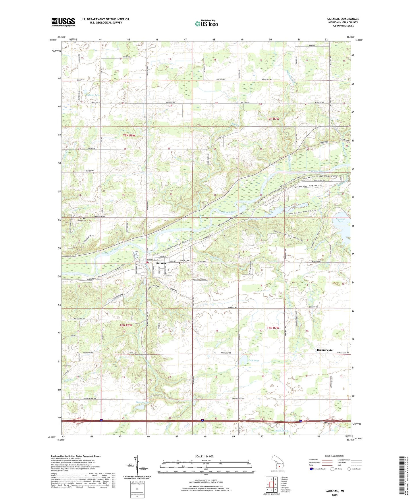
2023 topographic map quadrangle Saranac in the state of Michigan. Scale: 1:24000. Based on the newly updated USGS 7.5' US Topo map series, this map is in the following counties: Ionia. The map contains contour data, water features, and other items you are used to seeing on USGS maps, but also has updated roads and other features. This is the next generation of topographic maps. Printed on high-quality waterproof paper with UV fade-resistant inks.
Quads adjacent to this one:
West: Lowell
Northwest: Smyrna
North: Belding
Northeast: Shiloh
East: Ionia
Southeast: Woodbury
South: Lake Odessa
Southwest: Freeport
This map covers the same area as the classic USGS quad with code o42085h2.
Contains the following named places: Bellamy Creek, Berlin Center, Cahoon Lake, Crooked Creek, Easton Church, Easton Post Office, Family Health Center-Saranac, Fisher Lake, Galilee Baptist Church, Harker Middle School, Ionia State Recreation Area, Keene Post Office, Lake Creek, Leary Drain, Little Creek, Marker Lake, New Berlin Post Office, Peck Lake, Potters Corners, Red Creek, Saint Anthony's Catholic Church, Saranac, Saranac Cemetery, Saranac Community Church, Saranac Community Fire Department, Saranac Elementary School, Saranac High School, Saranac Historical Marker, Saranac Post Office, Saranac Public Library, Saranac Rest Area, Saranac Station, Scheid Park, Sessions Creek, Sessions Lake, Timberland Creek, Township of Berlin, Township of Easton, Village of Saranac, White Cemetery, ZIP Code: 48881