MyTopo
Freeport Michigan US Topo Map
Couldn't load pickup availability
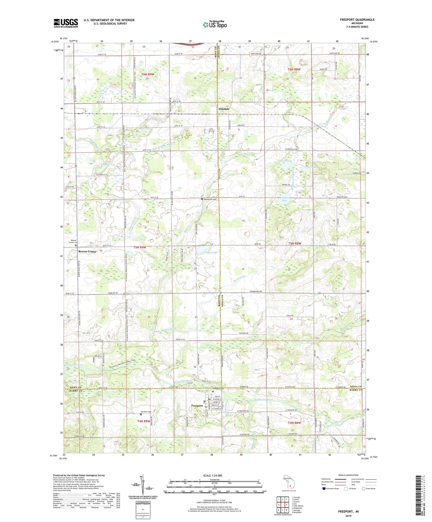
2023 topographic map quadrangle Freeport in the state of Michigan. Scale: 1:24000. Based on the newly updated USGS 7.5' US Topo map series, this map is in the following counties: Ionia, Kent, Barry. The map contains contour data, water features, and other items you are used to seeing on USGS maps, but also has updated roads and other features. This is the next generation of topographic maps. Printed on high-quality waterproof paper with UV fade-resistant inks.
Quads adjacent to this one:
West: Alto
Northwest: Cascade
North: Lowell
Northeast: Saranac
East: Lake Odessa
Southeast: Woodland
South: Hastings
Southwest: Middleville
This map covers the same area as the classic USGS quad with code o42085g3.
Contains the following named places: Apostolic Christian Church, Bear Creek, Bear Swamp Drain, Bond Drain, Bowne Center, Bowne Center Cemetery, Bowne Center United Methodist Church, Bowne Church, Bowne Post Office, Calvary Church, Church Lake, Duck Creek, Elmdale, Elmdale Church of the Nazarene, Elmdale Post Office, Elmdale Station, Fillmore Post Office, Freeport, Freeport Area Volunteer Fire Department, Freeport Cemetery, Freeport District Library, Freeport Police Department, Freeport Post Office, Freeport United Brethren Church, Freeport United Methodist Church, Freeport Village Hall, Geiger Drain, German Cemetery, Hess Lake, Hope Church, Johnson Airport, Kilgus Branch, Lake Number Ten, Lake School, Logan Lake, Logan Post Office, Lowell Fire Department, Mennonite Cemetery, Messer Brook, Middleville State Game Area, Peddler Lake, Peddler Lake Drain, Pleasant Valley Church, Smelker Drain, Stecklee Drain, Township of Bowne, Township of Campbell, Tyler Creek Golf Club, Village of Freeport, Walton Drain, West Campbell Post Office, ZIP Codes: 48815, 49325