MyTopo
Seney NW Michigan US Topo Map
Couldn't load pickup availability
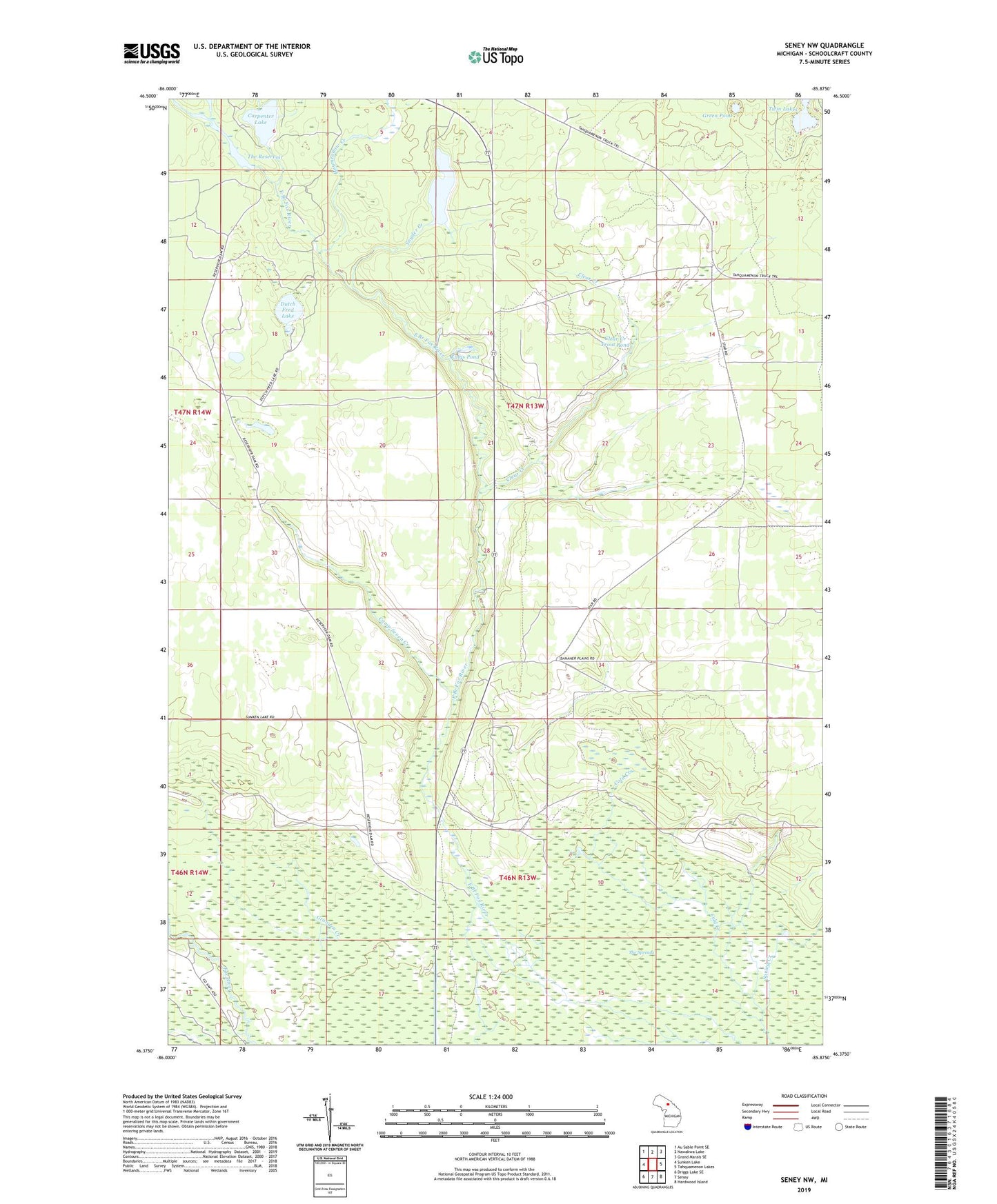
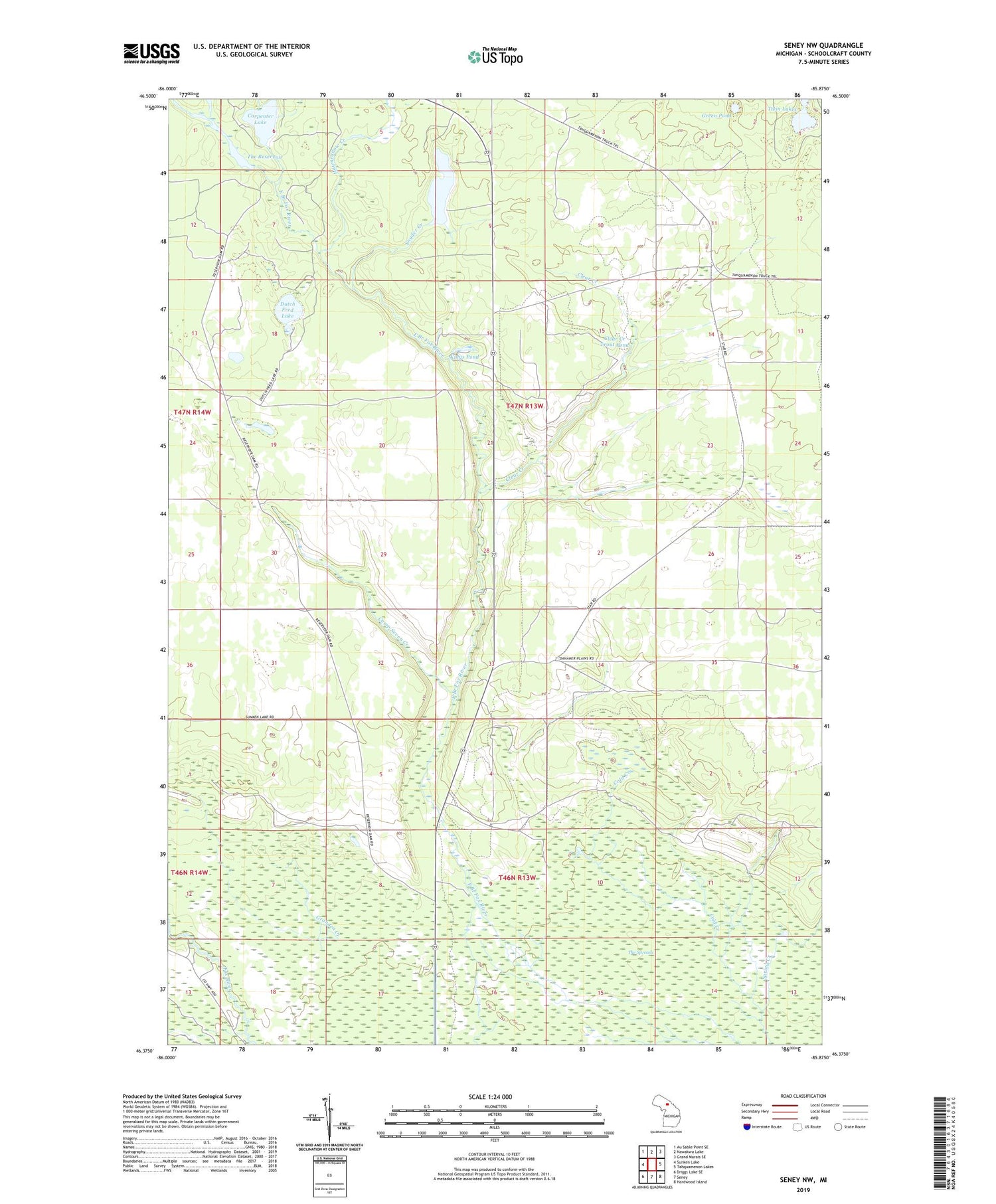
2019 topographic map quadrangle Seney NW in the state of Michigan. Scale: 1:24000. Based on the newly updated USGS 7.5' US Topo map series, this map is in the following counties: Schoolcraft. The map contains contour data, water features, and other items you are used to seeing on USGS maps, but also has updated roads and other features. This is the next generation of topographic maps. Printed on high-quality waterproof paper with UV fade-resistant inks.
Quads adjacent to this one:
West: Sunken Lake
Northwest: Au Sable Point SE
North: Nawakwa Lake
Northeast: Grand Marais SE
East: Tahquamenon Lakes
Southeast: Hardwood Island
South: Seney
Southwest: Driggs Lake SE
Contains the following named places: Camp Seven Creek, Carpenter Lake, Clear Creek, Clear Creek Trout Pond, Dutch Fred Lake, East Branch Fox River State Forest Campground, Green Pond, Gronden Creek, Haymeadow Creek, Kings Pond, Snyder Creek, Snyder Lake, Spring Creek, The Reservoir, Twin Lakes