
MyTopo
Seney Michigan US Topo Map
Couldn't load pickup availability
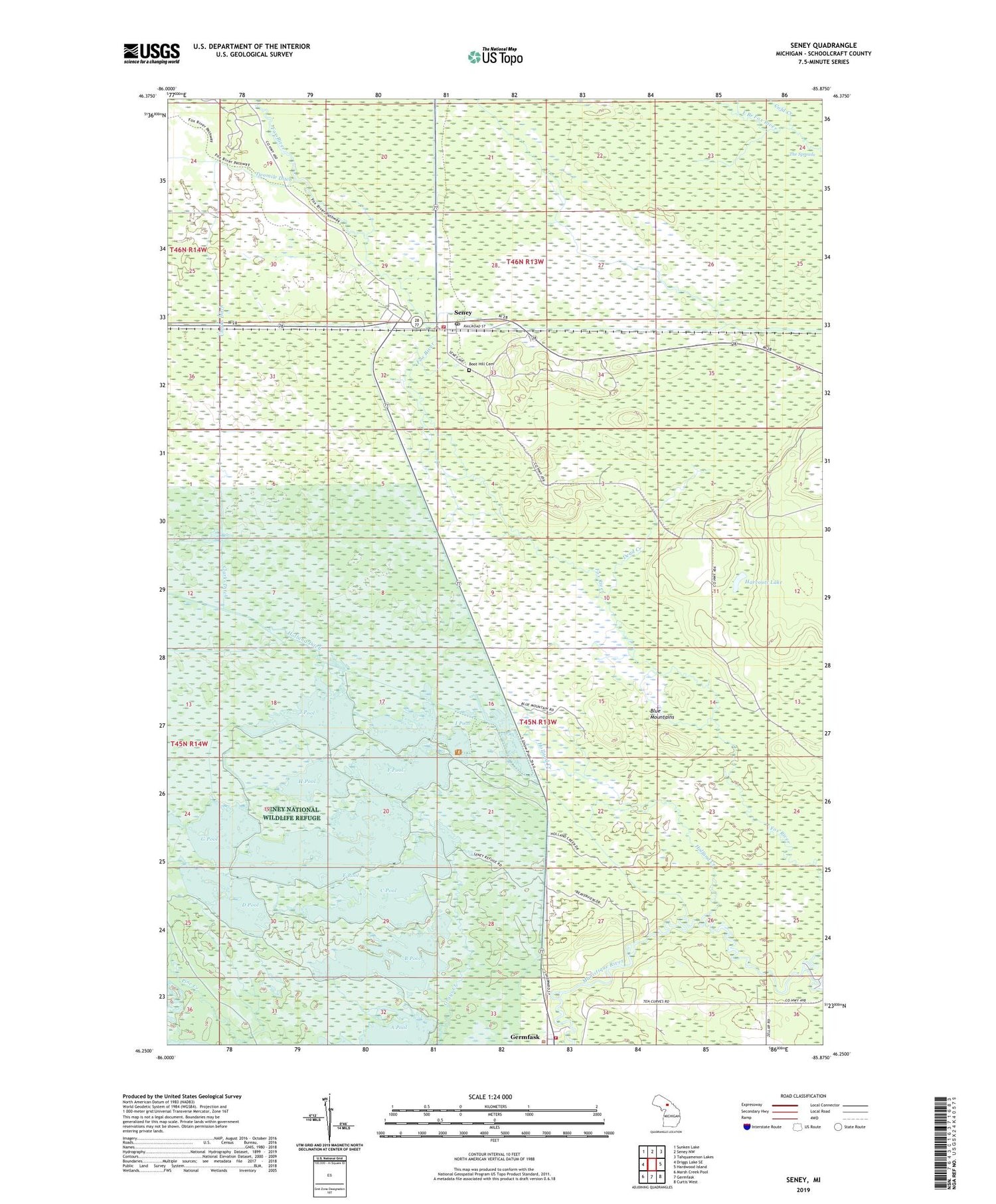
2019 topographic map quadrangle Seney in the state of Michigan. Scale: 1:24000. Based on the newly updated USGS 7.5' US Topo map series, this map is in the following counties: Schoolcraft. The map contains contour data, water features, and other items you are used to seeing on USGS maps, but also has updated roads and other features. This is the next generation of topographic maps. Printed on high-quality waterproof paper with UV fade-resistant inks.
Quads adjacent to this one:
West: Driggs Lake SE
Northwest: Sunken Lake
North: Seney NW
Northeast: Tahquamenon Lakes
East: Hardwood Island
Southeast: Curtis West
South: Germfask
Southwest: Marsh Creek Pool
Contains the following named places: B Pool, Blue Mountains, Boot Hill Cemetery, C Pool, Clarks Ditch, Cold Creek, D Pool, Dead Creek, E Pool, F Pool, Fox River, G Pool, Germfask Volunteer Fire Department, Gronden Creek, H Pool, Harcourt Lake, Holland Creek, Holland Ditch, I Pool, J Pool, Michigan Department of Natural Resources Seney Field Office, Seney, Seney Post Office, Seney Station, Seney Township Fire Department, The Spreads, Township Campground, Wigwam Picnic Area


