MyTopo
Germfask Michigan US Topo Map
Couldn't load pickup availability
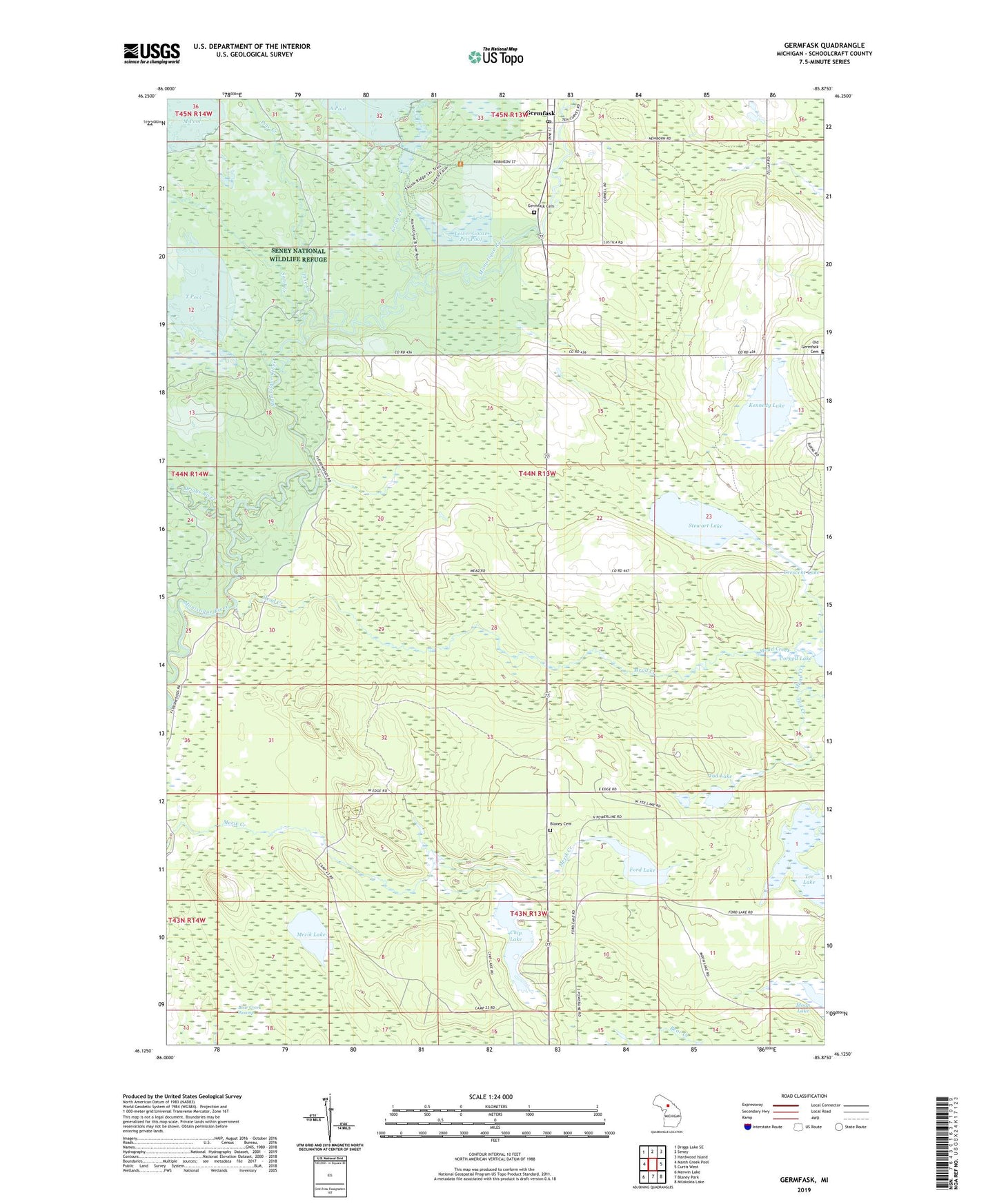
2023 topographic map quadrangle Germfask in the state of Michigan. Scale: 1:24000. Based on the newly updated USGS 7.5' US Topo map series, this map is in the following counties: Schoolcraft. The map contains contour data, water features, and other items you are used to seeing on USGS maps, but also has updated roads and other features. This is the next generation of topographic maps. Printed on high-quality waterproof paper with UV fade-resistant inks.
Quads adjacent to this one:
West: Marsh Creek Pool
Northwest: Driggs Lake SE
North: Seney
Northeast: Hardwood Island
East: Curtis West
Southeast: Milakokia Lake
South: Blaney Park
Southwest: Merwin Lake
This map covers the same area as the classic USGS quad with code o46085b8.
Contains the following named places: A Pool, Big Cedar Campground, Blaney Cemetery, Chip Lake, Driggs River, Ford Lake, Germfask, Germfask Cemetery, Germfask Church, Germfask Post Office, Germfask Station, Germfask United Methodist Church, Grace Church, Grays Creek, Kennedy Lake, Lower Goose Pen Pool, Mead Creek, Mead Creek Campground, Mezik Lake, Old Germfask Cemetery, Pine Creek, Sand Creek, Stewart Lake, T Pool, Tad Creek, Tad Lake, Tee Lake, Township of Germfask, Upper Goose Pen Pool, ZIP Code: 49836