MyTopo
Sodus Michigan US Topo Map
Couldn't load pickup availability
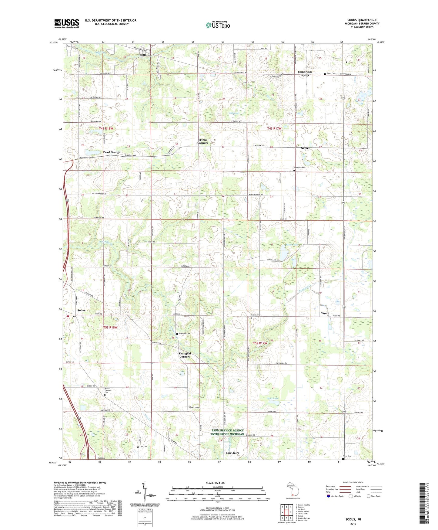
2023 topographic map quadrangle Sodus in the state of Michigan. Scale: 1:24000. Based on the newly updated USGS 7.5' US Topo map series, this map is in the following counties: Berrien. The map contains contour data, water features, and other items you are used to seeing on USGS maps, but also has updated roads and other features. This is the next generation of topographic maps. Printed on high-quality waterproof paper with UV fade-resistant inks.
Quads adjacent to this one:
West: Benton Harbor
Northwest: Benton Heights
North: Coloma
Northeast: Hartford
East: Sister Lakes
Southeast: Sumnerville
South: Berrien Springs
Southwest: Baroda
This map covers the same area as the classic USGS quad with code o42086a3.
Contains the following named places: Bainbridge Center, Bainbridge Post Office, Black Lake, Brant Cemetery, Bright Star Tabernacle Church, Byers Cemetery, Chapel Hill United Methodist Church, Countryside Charter School, Eau Claire Church, Eau Claire Seventh-Day Adventist Church, Eau Claire Seventh-Day Adventist School, Ferry Cemetery, Grace Christian School, Hartman, Hartman Post Office, Lett Cemetery, Macedonia Community Church, Millburg, Millburg Academy, Millburg Census Designated Place, Millburg Post Office, Mills Lake, Mount Pleasant Cemetery, Mud Lake, Naomi, Naomi Post Office, Naomi Station, Napier, Pearl Cemetery, Pearl Grange, Pearl School, Pennyan Cemetery, Penyann Post Office, Pipestone Creek Golf Course, Pipestone Post Office, Pipestone Station, Saint Paul's Lutheran Church, Saint Paul's Lutheran School, Shanghai Cemetery, Shanghai Corners, Sodus, Sodus Post Office, Sodus Station, Sodus Township Fire Department, Sodus Township Hall, Sodus Township Library, Spinks Corners, Spinks Corners Post Office, Township of Bainbridge, Township of Pipestone, Township of Sodus, WIRX-FM (Saint Joseph), WXSB-FM (Benton Harbor), ZIP Codes: 49022, 49111, 49126