MyTopo
Tawas City Michigan US Topo Map
Couldn't load pickup availability
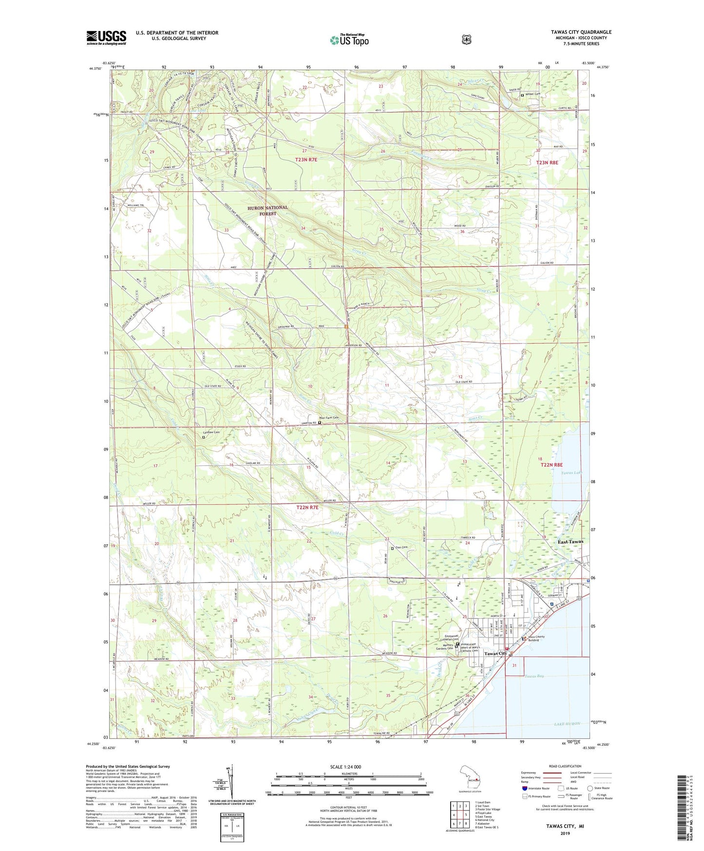
2019 topographic map quadrangle Tawas City in the state of Michigan. Scale: 1:24000. Based on the newly updated USGS 7.5' US Topo map series, this map is in the following counties: Iosco. The map contains contour data, water features, and other items you are used to seeing on USGS maps, but also has updated roads and other features. This is the next generation of topographic maps. Printed on high-quality waterproof paper with UV fade-resistant inks.
Quads adjacent to this one:
West: Floyd Lake
Northwest: Loud Dam
North: Sid Town
Northeast: Foote Site Village
East: East Tawas
Southeast: East Tawas OE S
South: Alabaster
Southwest: National City
Contains the following named places: Ascension Saint Joseph Hospital, City of Tawas City, Clara Bolen Elementary School, Cold Creek, Community of Christ Church, Dead Creek, Emanuel Lutheran Church, Emanuel Lutheran School, Emmanuel Lutheran Cemetery, Gateway Park, Huron Family Medicine Clinic, Immaculate Heart of Mary's Catholic Cemetery, Iosco County Courthouse, Iosco County Sheriff's Office, Iosco Medical Care Facility, Johns Creek, Laidlaw Cemetery, Lost Lake, Memory Gardens Cemetery, Poor Farm Cemetery, Red Hawk Golf Club, Sims Creek, Tawas Area High School, Tawas Bay Family Practice Clinic, Tawas City, Tawas City Elementary School, Tawas City Fire Department, Tawas City Hall, Tawas City Library, Tawas City Post Office, Tawas City Station, Tawas Creek Golf Club, Tawas Police Authority, Tawas River, Tawas River Trailer Park, Tawas RV Park, Tawas Seventh Day Adventist Church, Tawas Township Hall, Tawas United Methodist Church, Township of Tawas, Trails End Ranch Campgrounds, Vine Post Office, Wilber Cemetery, Wilber Township Hall, WIOS-AM (Tawas City-East Tawas), Zion Cemetery, Zion Lutheran School, ZIP Codes: 48748, 48763