MyTopo
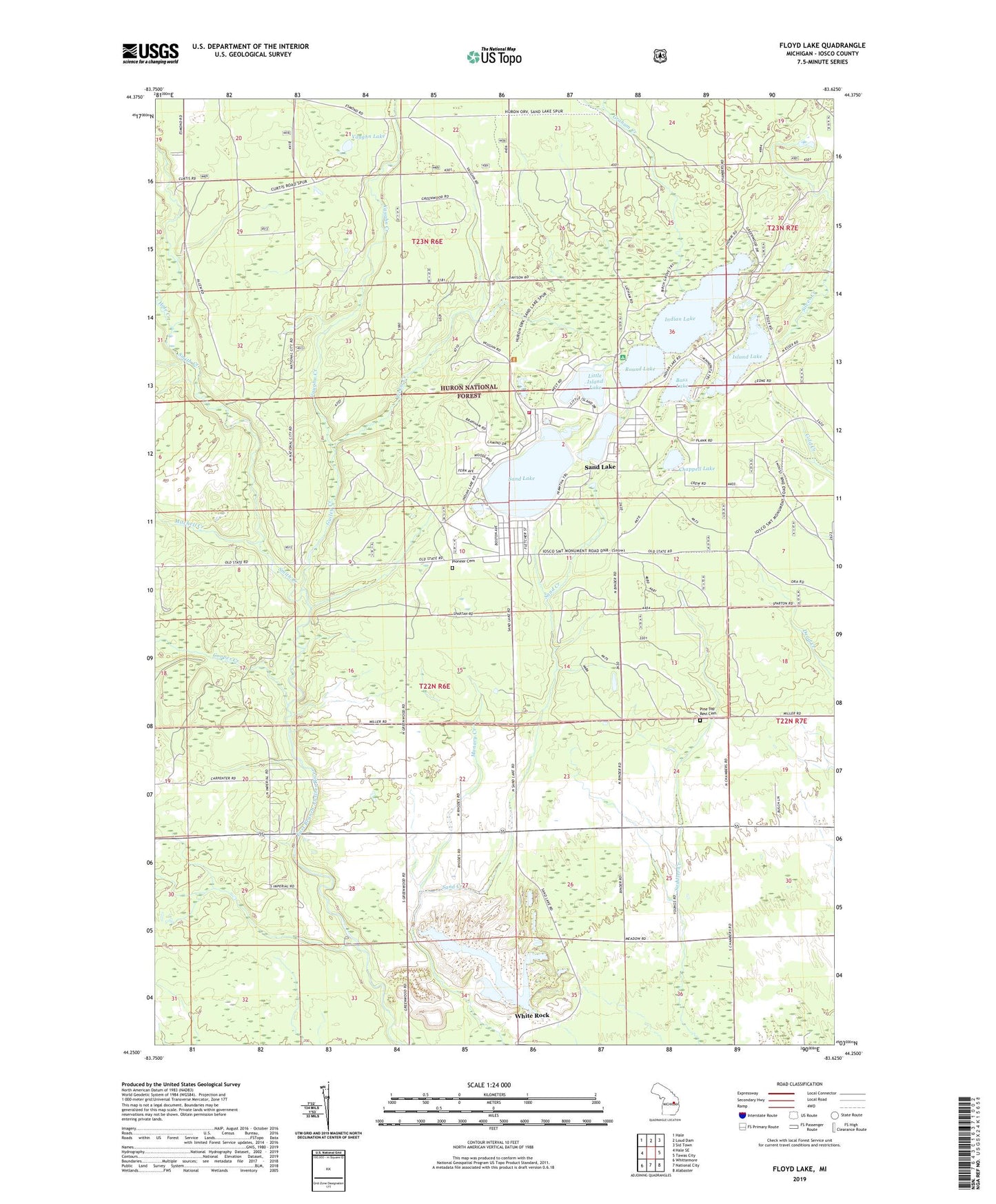
Floyd Lake Michigan US Topo Map
Couldn't load pickup availability
Also explore the Floyd Lake Forest Service Topo of this same quad for updated USFS data
2023 topographic map quadrangle Floyd Lake in the state of Michigan. Scale: 1:24000. Based on the newly updated USGS 7.5' US Topo map series, this map is in the following counties: Iosco. The map contains contour data, water features, and other items you are used to seeing on USGS maps, but also has updated roads and other features. This is the next generation of topographic maps. Printed on high-quality waterproof paper with UV fade-resistant inks.
Quads adjacent to this one:
West: Hale SE
Northwest: Hale
North: Loud Dam
Northeast: Sid Town
East: Tawas City
Southeast: Alabaster
South: National City
Southwest: Whittemore
This map covers the same area as the classic USGS quad with code o44083c6.
Contains the following named places: Au Gres River Roadside Park, Bass Lake, Chappell Lake, Cooper Creek, Edson Post Office, Floyd Lake, Graham Creek, Grant Township Fire Department, Guiley Creek, Guiley Pond, Hale Creek, Hemlock, Hemlock Road Church, Indian Lake, Iosco Post Office, Island Lake, Little Island Lake, Manary Creek, Meadow, Mitchell Creek, Ogemaw Post Office, Picket Creek, Pine Top Rest Cemetery, Pioneer Cemetery, Pioneer Cemetery Historical Marker, Round Lake, Round Lake Campground, Sand Lake, Sand Lake Census Designated Place, Smith Creek, Tawas Quarry, Township of Grant, Vaughn Creek, Vaughn Lake, WDBI-FM (Tawas City), White Rock