MyTopo
Jacks Landing Michigan US Topo Map
Couldn't load pickup availability
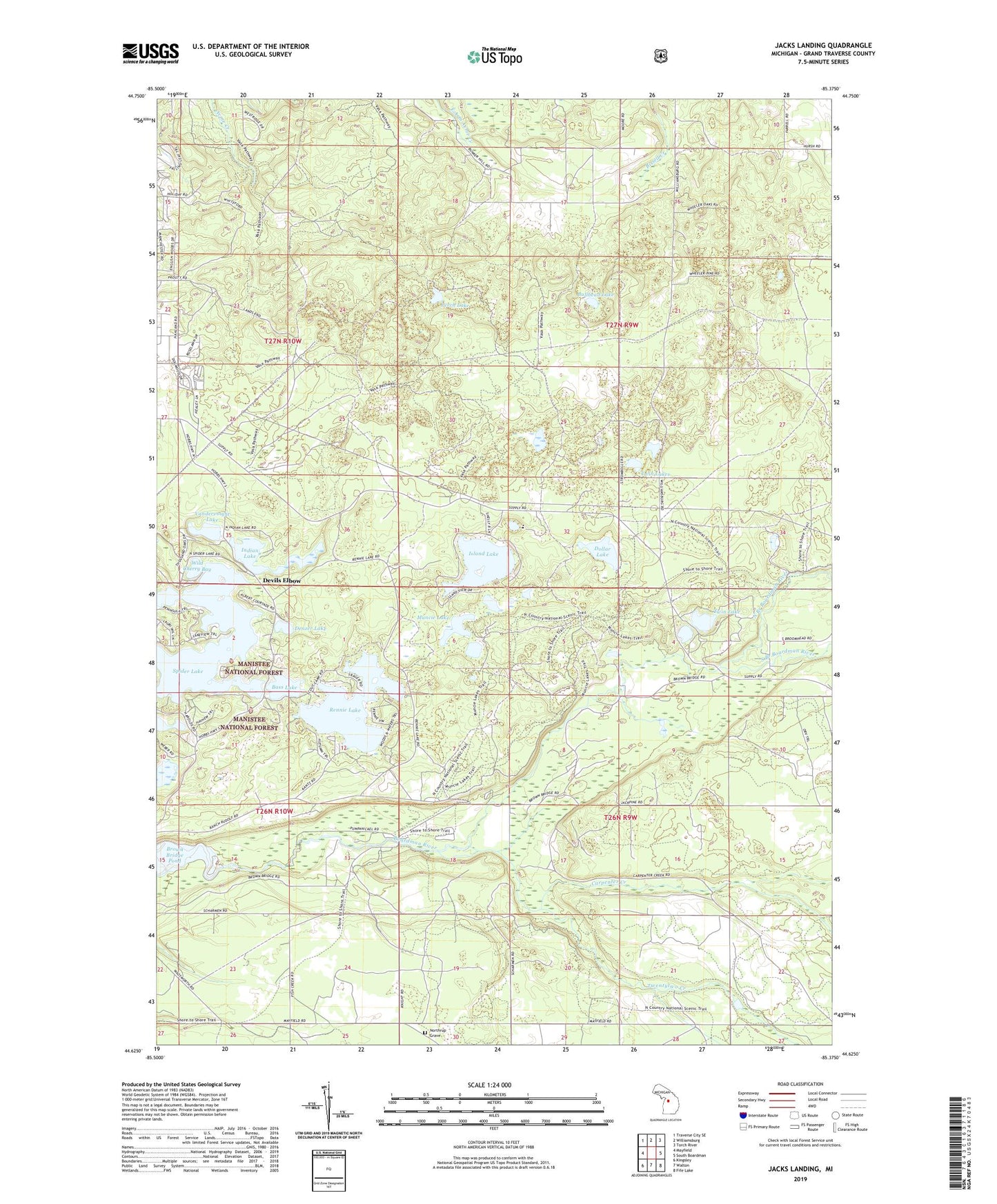
2023 topographic map quadrangle Jacks Landing in the state of Michigan. Scale: 1:24000. Based on the newly updated USGS 7.5' US Topo map series, this map is in the following counties: Grand Traverse. The map contains contour data, water features, and other items you are used to seeing on USGS maps, but also has updated roads and other features. This is the next generation of topographic maps. Printed on high-quality waterproof paper with UV fade-resistant inks.
Quads adjacent to this one:
West: Mayfield
Northwest: Traverse City SE
North: Williamsburg
Northeast: Torch River
East: South Boardman
Southeast: Fife Lake
South: Walton
Southwest: Kingsley
This map covers the same area as the classic USGS quad with code o44085f4.
Contains the following named places: Bass Lake, Bullhead Lake, Burr Island Park, Camp Greilick, Carpenter Creek, Denzer Lake, Devils Elbow, Dollar Lake, Forest Lakes Bible Church, Forks State Forest Campground, Grass Lake, Indian Lake, Island Lake, Jacks Landing, Muncie Lake, North Branch Boardman River, Northrup Grave, Perch Lake, Rennie Lake, Scheck's Place State Forest Campground, South Branch Boardman River, Spider Lake, Timber Ridge Campground, Township of Union, Twentytwo Creek, Twin Lake, Twin Lakes, Vandervoight Lake, Wild Cherry Bay