
MyTopo
Town Corners Michigan US Topo Map
Couldn't load pickup availability
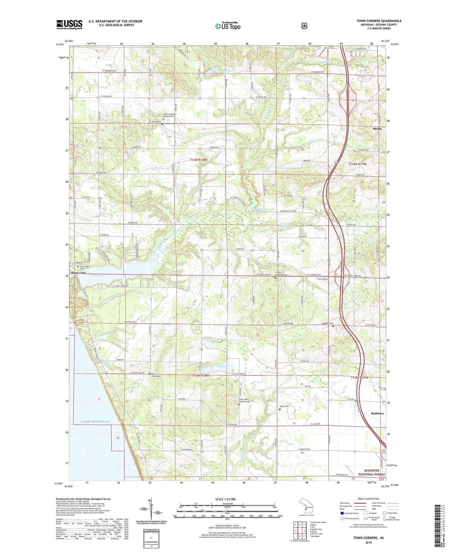
2019 topographic map quadrangle Town Corners in the state of Michigan. Scale: 1:24000. Based on the newly updated USGS 7.5' US Topo map series, this map is in the following counties: Oceana. The map contains contour data, water features, and other items you are used to seeing on USGS maps, but also has updated roads and other features. This is the next generation of topographic maps. Printed on high-quality waterproof paper with UV fade-resistant inks.
Quads adjacent to this one:
West: Bigsbie Lake
Northwest: Little Point Sable
North: Mears
Northeast: Hart
East: Shelby
Southeast: Montague
South: Flower Creek
Contains the following named places: Bender Creek, Benona School, Benona Township Hall Historical Marker, Bradyville School, Burke Creek, Claybanks Post Office, Claybanks Township Memorial Park, Claybanks Township Park, Cranston Cemetery, Cranston School, Dorrance Creek, Gardner Cemetery, Girdle Road School, Grand View Golf Course, Jakes Lake, Long Lake, Marshville Pond, Marshville Post Office, Marshville Roadside Park, Mason Creek, Park Lake, Peace Cemetery, Peace Church, Pine Grove Cemetery, Pine Grove School, Piper Creek, Saddleback Lake, Saint John's Catholic Cemetery, Saint Johns Church, Saint Stephens Church, Saint Stephen's Lutheran Cemetery, Shelby Road Church, Stoney Haven Campground, Stony Lake, Stony Lake Cemetery, Stony Lake Oil Field, Town Corners, Township of Benona, Township of Claybanks, Trinity Church, Trinity Lutheran Cemetery, Whisky Creek, Woodland School, ZIP Codes: 49446, 49455


