MyTopo
Mears Michigan US Topo Map
Couldn't load pickup availability
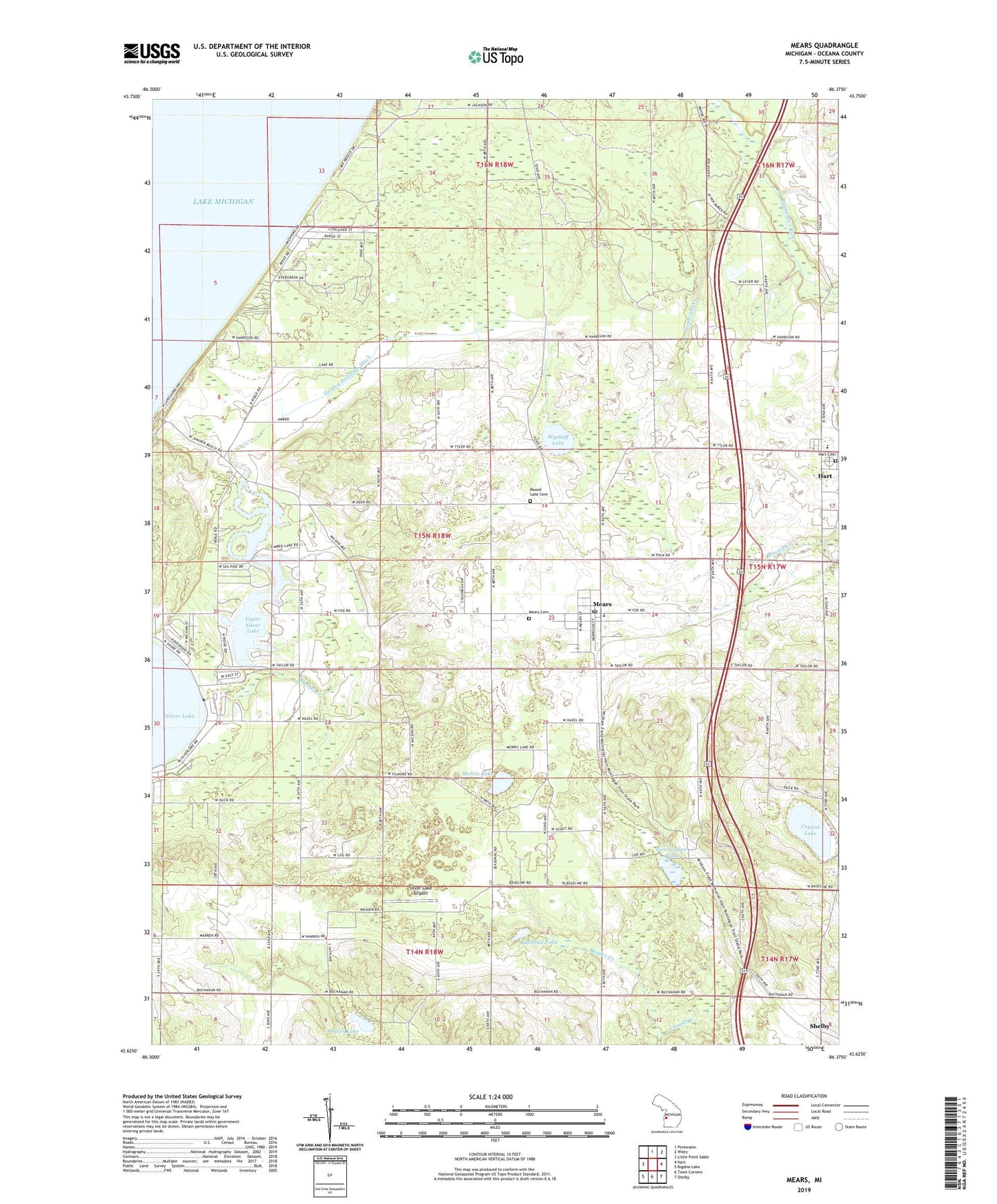
2023 topographic map quadrangle Mears in the state of Michigan. Scale: 1:24000. Based on the newly updated USGS 7.5' US Topo map series, this map is in the following counties: Oceana. The map contains contour data, water features, and other items you are used to seeing on USGS maps, but also has updated roads and other features. This is the next generation of topographic maps. Printed on high-quality waterproof paper with UV fade-resistant inks.
Quads adjacent to this one:
West: Little Point Sable
North: Pentwater
Northeast: Wiley
East: Hart
Southeast: Shelby
South: Town Corners
Southwest: Bigsbie Lake
This map covers the same area as the classic USGS quad with code o43086f4.
Contains the following named places: Au Sable Creek, Bullhead Pond, Cargill Creek, Cedar Point Park, Church of Jesus Christ of Latter Day Saints, Colonial Golf Courses, Cornerstone Community Church, Crystal Lake, East Golden Pond, East Golden Post Office, East Golden Station, First Baptist Church, Garver School, Golden Drainage Ditch, Golden Elementary School, Golden Sands Golf Course, Golding Post Office, Hart Cemetery, Hart Rest Area, Homer Lake, Hovey School, Hunter Creek, Lake Michigan United Methodist Church, Lambricks Creek, Mears, Mears Cemetery, Mears Census Designated Place, Mears Methodist Church, Mears Post Office, Mears Station, Memorial Family Care Center, Mission Covenant Church, Morris Lake, Oceana Christian School, Oceana County Historical Park and Museum, Pines Mobile Home Park, River Farm Campground, Round Lake Cemetery, Round Lake School, Silver City II Campground, Silver Creek RV Resort, Silver Lake Airport, Silver Lake Resort and Campground, Silver Lake State Park Campground, Township of Golden, Upper Silver Lake, West Golden Church, West Golden Wesleyan Church, Wilson School, WSAB-FM (Pentwater), WVKG-FM (Pentwater), Wyckoff Lake, Yogi's Bears Jellystone Park, ZIP Code: 49436