MyTopo
Little Point Sable Michigan US Topo Map
Couldn't load pickup availability
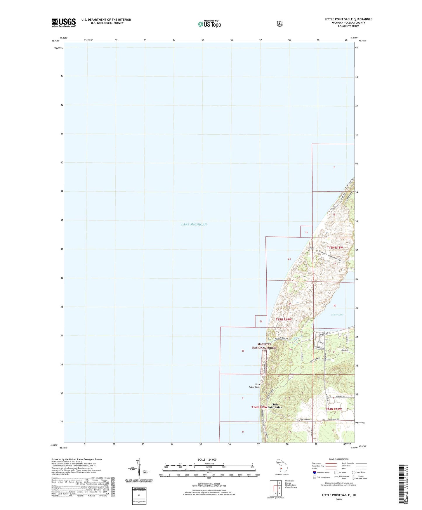
2023 topographic map quadrangle Little Point Sable in the state of Michigan. Scale: 1:24000. Based on the newly updated USGS 7.5' US Topo map series, this map is in the following counties: Oceana. The map contains contour data, water features, and other items you are used to seeing on USGS maps, but also has updated roads and other features. This is the next generation of topographic maps. Printed on high-quality waterproof paper with UV fade-resistant inks.
Quads adjacent to this one:
Northeast: Pentwater
East: Mears
Southeast: Town Corners
South: Bigsbie Lake
This map covers the same area as the classic USGS quad with code o43086f5.
Contains the following named places: Charles Mears Silver Lake Boarding House Historical Marker, Golden Township Park, Hideway Campground, Little Point Sable, Little Point Sable Lighthouse, Little Point Sable Post Office, Little Sable Point, Oceana County, Richmonds Inlet, Sandy Shores Campground, Silver Creek, Silver Lake, Silver Lake State Park