MyTopo
Point Mills Michigan US Topo Map
Couldn't load pickup availability
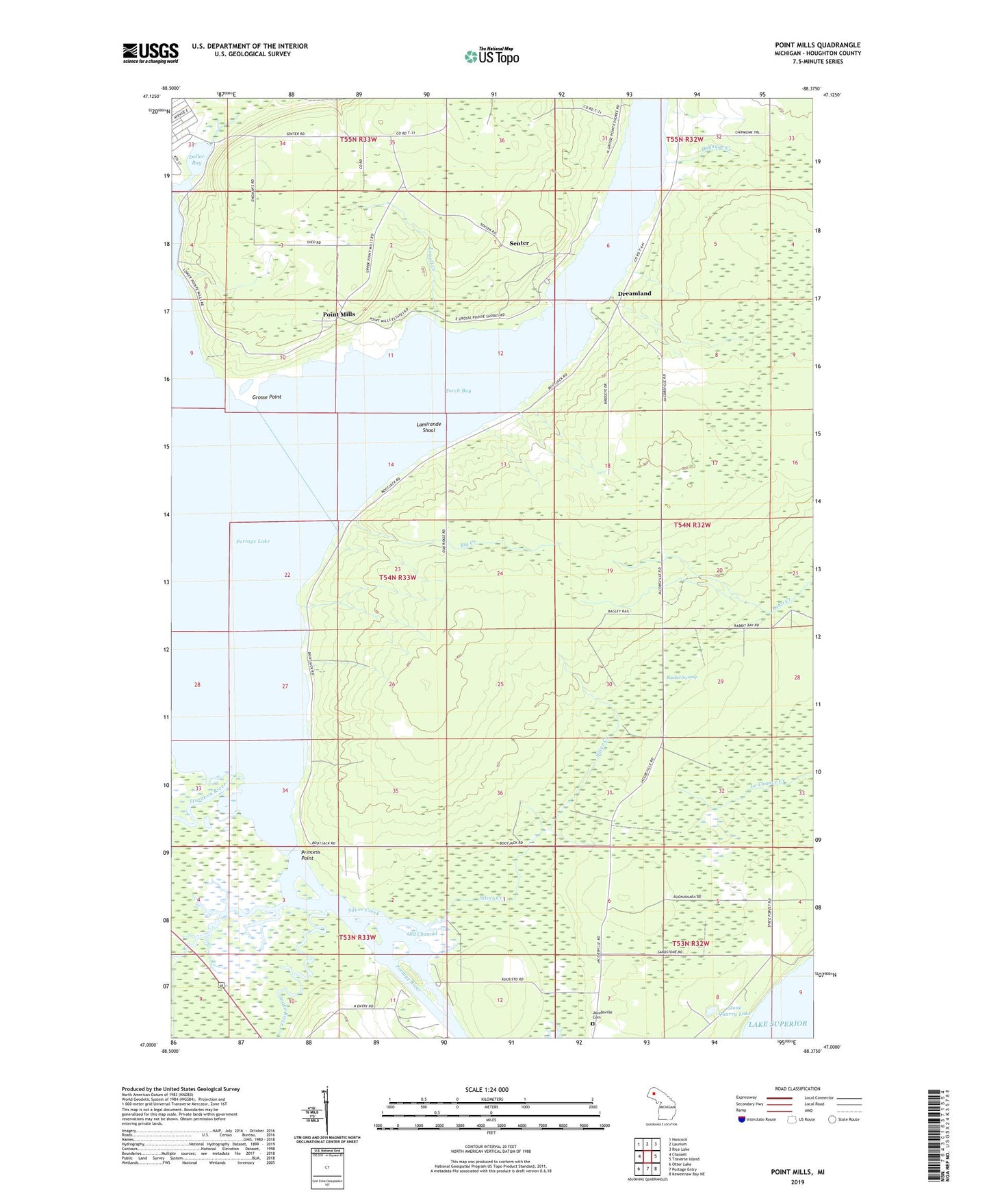
2023 topographic map quadrangle Point Mills in the state of Michigan. Scale: 1:24000. Based on the newly updated USGS 7.5' US Topo map series, this map is in the following counties: Houghton. The map contains contour data, water features, and other items you are used to seeing on USGS maps, but also has updated roads and other features. This is the next generation of topographic maps. Printed on high-quality waterproof paper with UV fade-resistant inks.
Quads adjacent to this one:
West: Chassell
Northwest: Hancock
North: Laurium
Northeast: Rice Lake
East: Traverse Island
Southeast: Keweenaw Bay NE
South: Portage Entry
Southwest: Otter Lake
This map covers the same area as the classic USGS quad with code o47088a4.
Contains the following named places: Big Creek, Bushel Swamp, Dollar Bay, Dreamland, Dubuque Creek, Gooseneck Creek, Grosse Point, Jacobsville Cemetery, Julio Contracting Company, Lamirande Shoal, Lovell Creek, Mills Station, Old Channel, Point Mills, Point Mills Post Office, Portage Lake, Portage River, Princess Point, Princess Point School, Sarazin School, Senter, Senter Post Office, Senter Station, Silver Creek, Snake River, Stone Quarry Lake, Sturgeon River, Torch Bay, Township of Torch Lake, ZIP Code: 49922