MyTopo
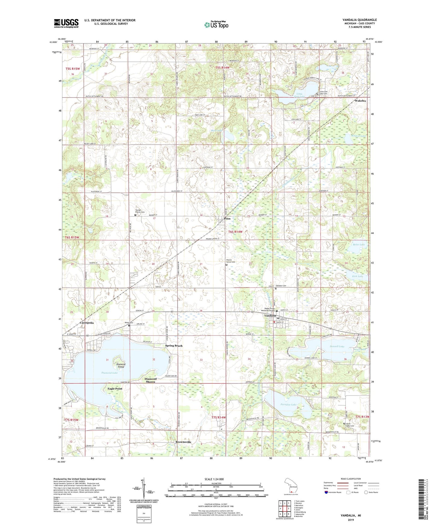
Vandalia Michigan US Topo Map
Couldn't load pickup availability
2023 topographic map quadrangle Vandalia in the state of Michigan. Scale: 1:24000. Based on the newly updated USGS 7.5' US Topo map series, this map is in the following counties: Cass. The map contains contour data, water features, and other items you are used to seeing on USGS maps, but also has updated roads and other features. This is the next generation of topographic maps. Printed on high-quality waterproof paper with UV fade-resistant inks.
Quads adjacent to this one:
West: Dowagiac
Northwest: Twin Lakes
North: Decatur
Northeast: Marcellus
East: Jones
Southeast: Mottville
South: Adamsville
Southwest: Edwardsburg
This map covers the same area as the classic USGS quad with code o41085h8.
Contains the following named places: Allegheny School, Belas Lake, Bethel Church, Birch Lake Cemetery, Birch Lake Church, Bogue Street Memorial Garden, Bonine Elk Park, Briar Patch School, Brownsville, Brownsville Post Office, Calvin Center Seventh Day Adventist Church, Calvin Center Seventh Day Adventist School, Camp Bryan, Camp Cozy, Camp Manitou, Camp Matthews, Cass County, Diamond Island, Diamond Lake, Diamond Lake Church, Diamond Lake Golf Club, Diamond Shores, Donnell Lake, Eagle Point, East School, First Church of God, Fish Lake School, Geneva School, Gospel Lighthouse Church, Kirk Lake, Lake Regional Conference Camp, Lewis Lake, Little Fish Lake, Little Fish Lake Cemetery, Long School, Maple Grove Trailer Park, Moon Cemetery, Muld Lake, Oakdale Cemetery, Paradise Lake, Park Shore Resort, Penn, Penn Friends Church, Penn Post Office, Penn Station, Penn Township Fire Department, Pleasant Hill School, Pleasant View Church, Prairie Grove Cemetery, Spring Beach, Stevens Memorial Park, Township of Penn, Underground Railroad Historical Marker, Vandalia, Vandalia Church of God, Vandalia Post Office, Vandalia Station, Vandalia Village Hall, Village of Vandalia, Wakelee, Wakelee Post Office, Wakelee Station, Wakelee United Methodist Church, White Temple School, Wildcat Lake, WSAD-FM (Vandalia), Youngs Prairie Cemetery, ZIP Codes: 49031, 49095


