MyTopo
Vanderbilt Michigan US Topo Map
Couldn't load pickup availability
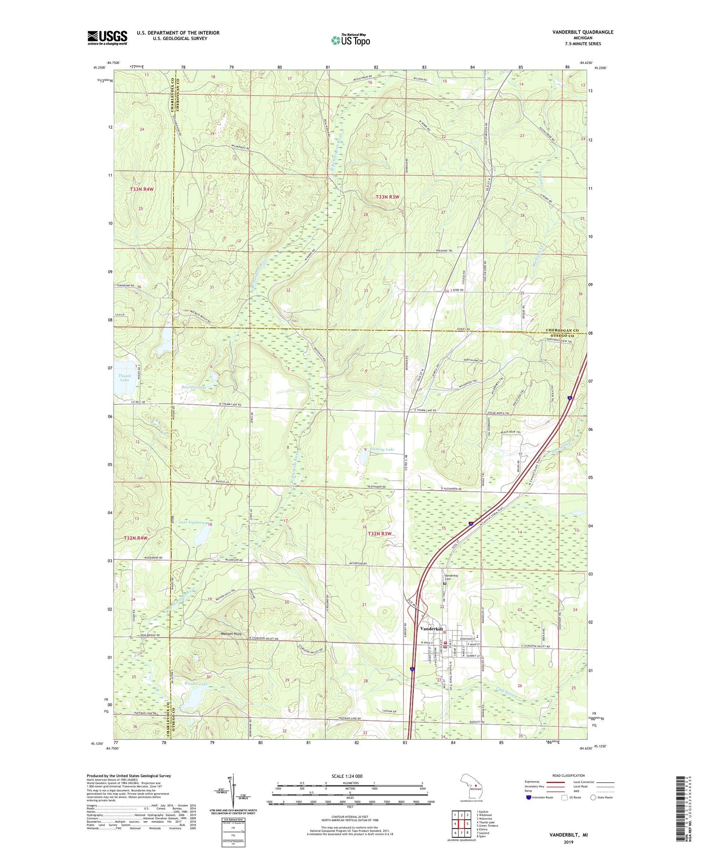
2023 topographic map quadrangle Vanderbilt in the state of Michigan. Scale: 1:24000. Based on the newly updated USGS 7.5' US Topo map series, this map is in the following counties: Otsego, Cheboygan, Charlevoix. The map contains contour data, water features, and other items you are used to seeing on USGS maps, but also has updated roads and other features. This is the next generation of topographic maps. Printed on high-quality waterproof paper with UV fade-resistant inks.
Quads adjacent to this one:
West: Thumb Lake
Northwest: Epsilon
North: Wildwood
Northeast: Wolverine
East: Green Timbers
Southeast: Sparr
South: Gaylord
Southwest: Elmira
This map covers the same area as the classic USGS quad with code o45084b6.
Contains the following named places: Berryville Post Office, Black Bear Golf Club, Fleming Lake, Holy Redeemer Church, Kingdom Hall of Jehovah's Witnesses, Lake Eighteen, Mill Street Mobile Home Park, Northern Lights Christian Church, Pigeon River Baptist Church, Reardon Lake, School Number 4, Standard Lake, Township of Wilmot, Vanderbilt, Vanderbilt / Corwith Fire and Rescue, Vanderbilt Area School, Vanderbilt Cemetery, Vanderbilt Community Church, Vanderbilt Library, Vanderbilt Post Office, Vanderbilt Station, Village of Vanderbilt, Watson Hills, Woodin Lake