MyTopo
Wildwood Michigan US Topo Map
Couldn't load pickup availability
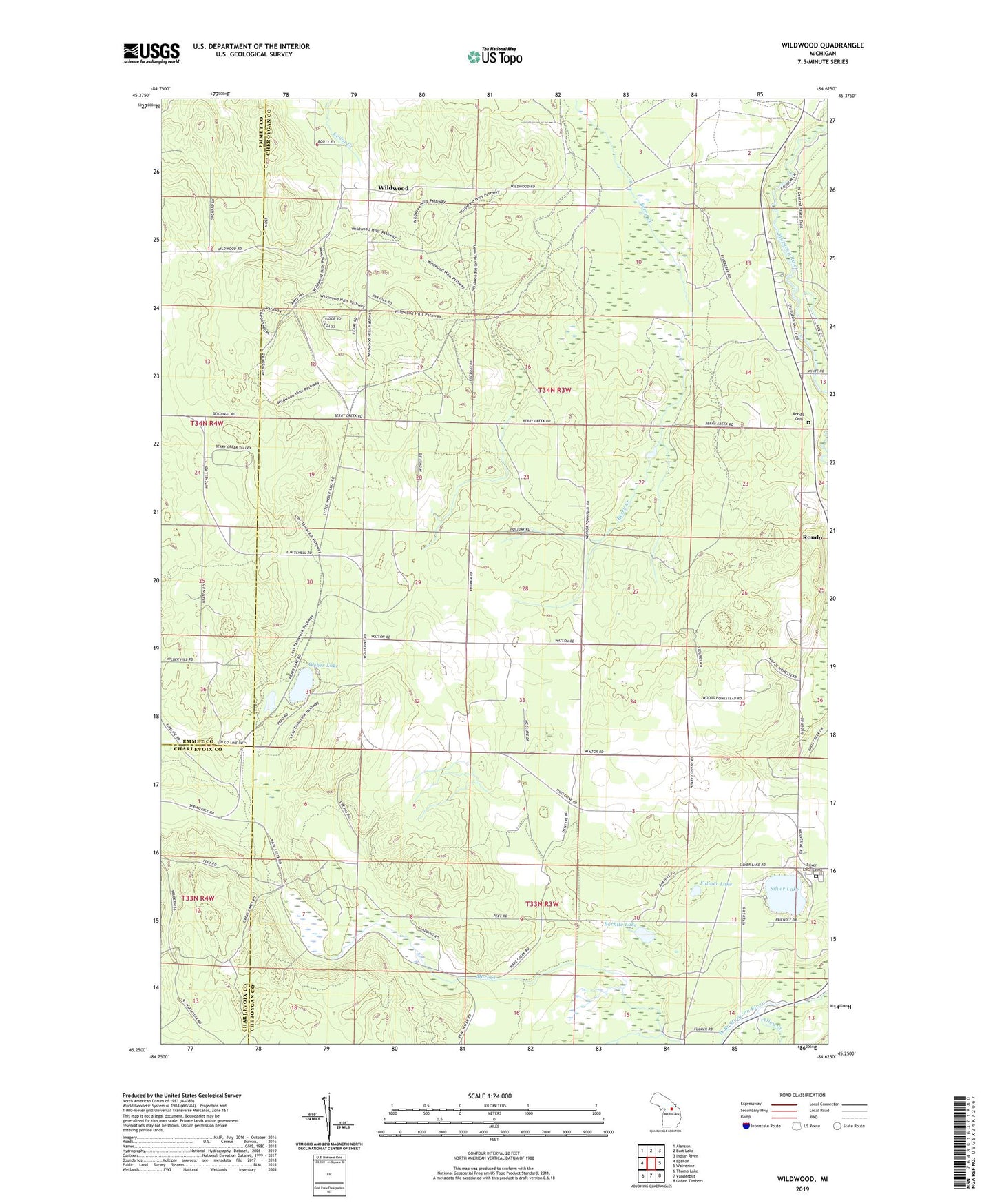
2023 topographic map quadrangle Wildwood in the state of Michigan. Scale: 1:24000. Based on the newly updated USGS 7.5' US Topo map series, this map is in the following counties: Cheboygan, Emmet, Charlevoix. The map contains contour data, water features, and other items you are used to seeing on USGS maps, but also has updated roads and other features. This is the next generation of topographic maps. Printed on high-quality waterproof paper with UV fade-resistant inks.
Quads adjacent to this one:
West: Epsilon
Northwest: Alanson
North: Burt Lake
Northeast: Indian River
East: Wolverine
Southeast: Green Timbers
South: Vanderbilt
Southwest: Thumb Lake
This map covers the same area as the classic USGS quad with code o45084c6.
Contains the following named places: Allen Creek, Barhite Lake, Fulmer Lake, Hope Lutheran Church, Indian River Catholic Shrine Cemetery, Joy Fellowship Assembly of God Church, Kingdom Hall of Jehovah's Witnesses, Marl Creek, Rondo Cemetery, Silver Lake, Silver Lake Cemetery, Township of Mentor, Weber Lake, Weber Lake State Forest Campground, Wildwood, Wildwood Post Office