MyTopo
Vestaburg Michigan US Topo Map
Couldn't load pickup availability
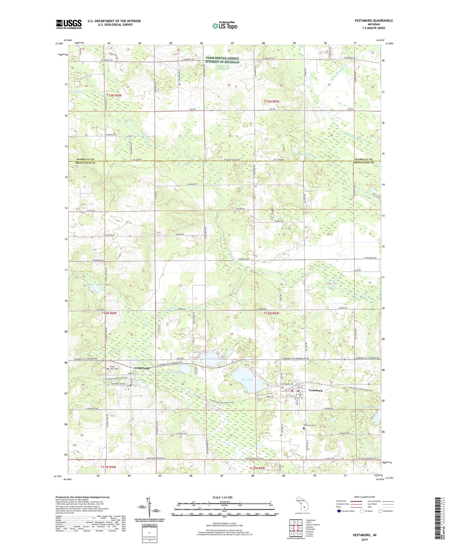
2019 topographic map quadrangle Vestaburg in the state of Michigan. Scale: 1:24000. Based on the newly updated USGS 7.5' US Topo map series, this map is in the following counties: Montcalm, Isabella. The map contains contour data, water features, and other items you are used to seeing on USGS maps, but also has updated roads and other features. This is the next generation of topographic maps. Printed on high-quality waterproof paper with UV fade-resistant inks.
Quads adjacent to this one:
West: Edmore
Northwest: Blanchard
North: Winn
Northeast: Mount Pleasant
East: Riverdale
Southeast: Sumner
South: Crystal
Southwest: Stanton
Contains the following named places: Bass Lake, Bullhead Lake, Cedar Drain, Cedar Lake, Cedar Lake Academy, Cedar Lake Cemetery, Cedar Lake Post Office, Cedar Lake School, Cedar Lake Station, Cornerstone Worship Center, Deaner Lake, Edmore State Game Area, Family Medical Care of Vestaburg, First Baptist Church, Kingdom Hall of Jehovah's Witnesses, Marl Lake, Offnear Lake, Pine River Church, Richland Cemetery, Richland Township Fire Department, Richland Township Library, Rock Lake, Skunk Creek, Thatcher Creek, Township of Richland, Vestaburg, Vestaburg Church of Christ, Vestaburg High School, Vestaburg Post Office, Vestaburg Station, Winn United Methodist Church, Wolf Creek, ZIP Code: 48891