MyTopo
Blanchard Michigan US Topo Map
Couldn't load pickup availability
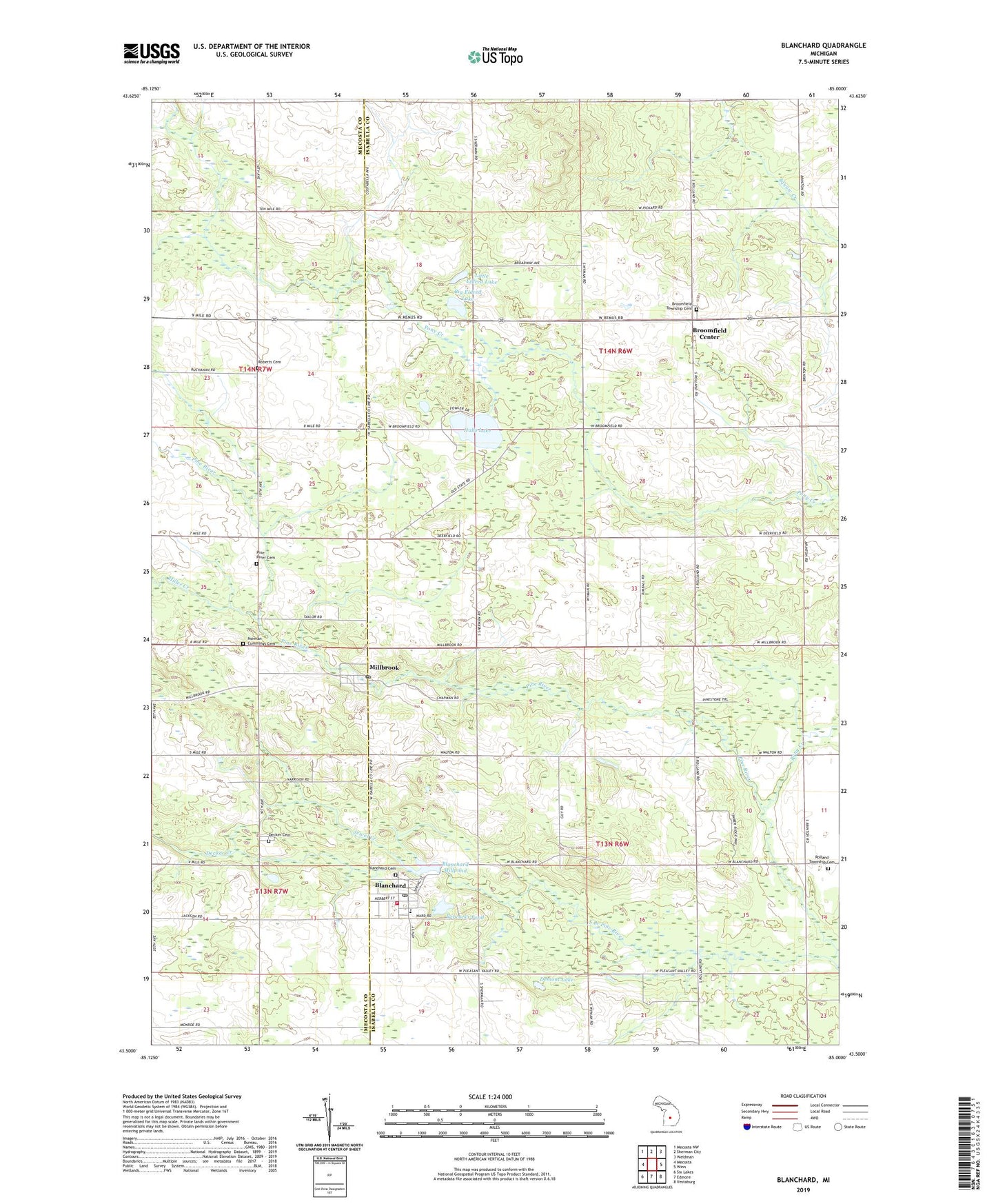
2023 topographic map quadrangle Blanchard in the state of Michigan. Scale: 1:24000. Based on the newly updated USGS 7.5' US Topo map series, this map is in the following counties: Isabella, Mecosta. The map contains contour data, water features, and other items you are used to seeing on USGS maps, but also has updated roads and other features. This is the next generation of topographic maps. Printed on high-quality waterproof paper with UV fade-resistant inks.
Quads adjacent to this one:
West: Mecosta
Northwest: Mecosta NW
North: Sherman City
Northeast: Weidman
East: Winn
Southeast: Vestaburg
South: Edmore
Southwest: Six Lakes
This map covers the same area as the classic USGS quad with code o43085e1.
Contains the following named places: Babcocks Pond, Big Eldred Lake, Blanchard, Blanchard Care/Family Practice, Blanchard Cemetery, Blanchard Elementary School, Blanchard Library, Blanchard Millpond, Blanchard Post Office, Blanchard Station, Blanchard Wesleyan Church, Broomfield Center, Broomfield Township Cemetery, Carney Lake, Church of God, Decker Cemetery, Decker Creek, Demont Lake, Free Methodist Church, Hall's Corner Holiness Church, Halls Lake, Jewel Creek, Little Eldred Lake, Millbrook, Millbrook / Rolland Township Fire Department, Millbrook Post Office, Millbrook Station, Miller Creek, Mud Lake, Norman-Cummings Cemetery, Pine River Cemetery, Pine River Church, Pine River Church Cemetery, Pony Creek, Roberts Cemetery, South Branch Pine River, Township of Broomfield, Township of Rolland, United by Faith Christian Church, West Millbrook Post Office, ZIP Codes: 49310, 49340