MyTopo
Walkerville West Michigan US Topo Map
Couldn't load pickup availability
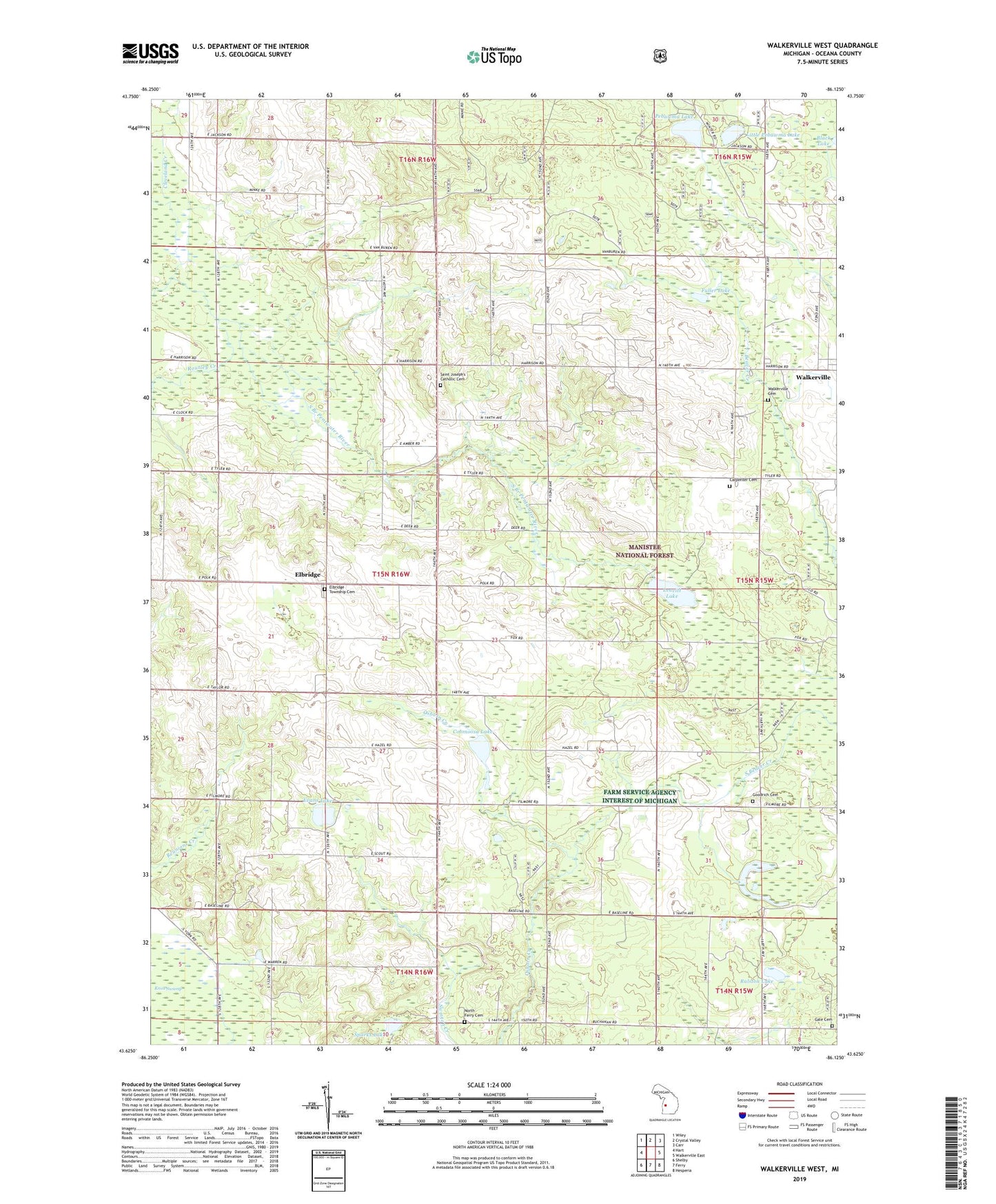
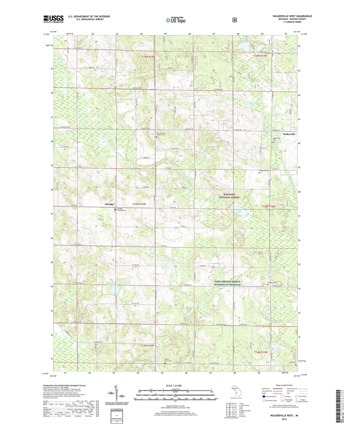
2019 topographic map quadrangle Walkerville West in the state of Michigan. Scale: 1:24000. Based on the newly updated USGS 7.5' US Topo map series, this map is in the following counties: Oceana. The map contains contour data, water features, and other items you are used to seeing on USGS maps, but also has updated roads and other features. This is the next generation of topographic maps. Printed on high-quality waterproof paper with UV fade-resistant inks.
Quads adjacent to this one:
West: Hart
Northwest: Wiley
North: Crystal Valley
Northeast: Carr
East: Walkerville East
Southeast: Hesperia
South: Ferry
Southwest: Shelby
Contains the following named places: Carpenter Cemetery, Cleveland Creek, Cobmoosa Lake, Elbridge, Elbridge Community Church, Elbridge Elementary School, Elbridge Post Office, Elbridge Township Cemetery, Evans Lake, Fuller Lake, Gale Cemetery, Gale School, Goodrich Cemetery, Indian Cemetery, Knox Swamp, Leavitt Lake, Little Pebawma Lake, North Ferry Cemetery, Pebawma Lake, Ralston Lake, Rathburn School, Raul Cemetery, Routley Creek, Saint Joseph's Catholic Cemetery, Saint Josephs Church, Sparks Lake, Township of Elbridge, Twin Bridges Corners, Village of Walkerville, Walkerville Cemetery, WCXT-FM (Hart)