MyTopo
Hesperia Michigan US Topo Map
Couldn't load pickup availability
Also explore the Hesperia Forest Service Topo of this same quad for updated USFS data
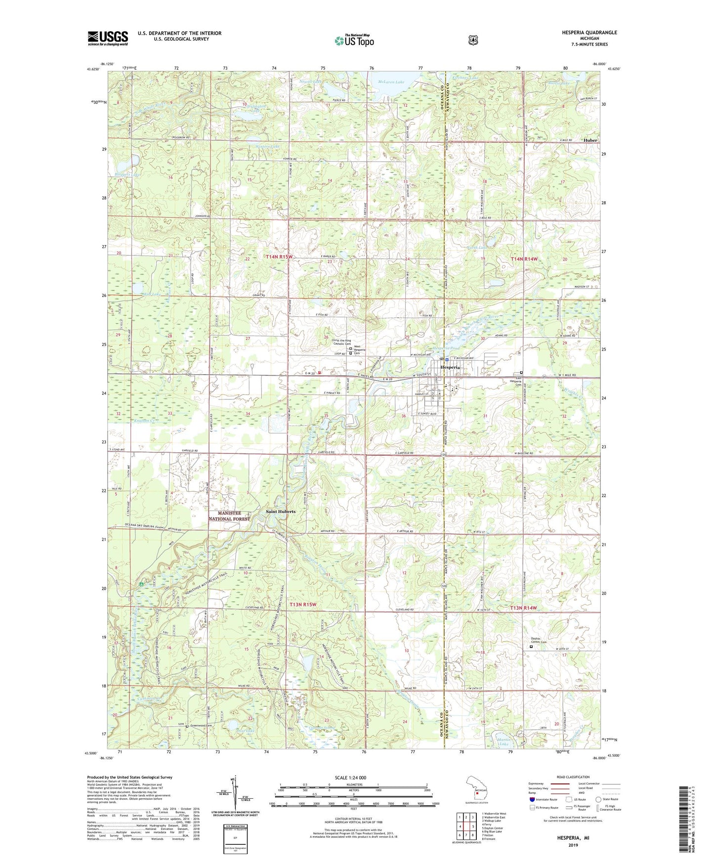
2023 topographic map quadrangle Hesperia in the state of Michigan. Scale: 1:24000. Based on the newly updated USGS 7.5' US Topo map series, this map is in the following counties: Oceana, Newaygo. The map contains contour data, water features, and other items you are used to seeing on USGS maps, but also has updated roads and other features. This is the next generation of topographic maps. Printed on high-quality waterproof paper with UV fade-resistant inks.
Quads adjacent to this one:
West: Ferry
Northwest: Walkerville West
North: Walkerville East
Northeast: Walkup Lake
East: Dayton Center
Southeast: Fremont
South: Holton
Southwest: Big Blue Lake
This map covers the same area as the classic USGS quad with code o43086e1.
Contains the following named places: Bloggett Lake, Brayton Drain, Burris Lake, Christ the King Catholic Cemetery, Christ the King Church, Countryside Church of Christ, Cushman Creek, Cushman Swamp, Darlington Lake, Doud School, East Hesperia Cemetery, Greenwood Cemetery, Greenwood Township Hall, Hesperia, Hesperia Area Fire Department, Hesperia Baptist Church, Hesperia Community Library, Hesperia High School, Hesperia Medical Center, Hesperia Police Department, Hesperia Pond, Hesperia Post Office, Hesperia Presbyterian Church, Hesperia United Methodist Church, Horseshoe Lake Cycle Trail, Jewell Cemetery, Kirchner Lake, Lighthouse Community Church, Lost Lake, Martin Lake, McGill School, Mud Lake, Newell Lake, North Lake, Pines Point Recreation Site, Podunk Canoe Access, Saint Huberts, Stebbinsville Post Office, Sturtevant School, Township of Greenwood, Township of Newfield, Village of Hesperia, Waterman School, WBLV-FM (Twin Lake), West Hesperia Cemetery, Winters Lake, Wrights Creek, ZIP Code: 49421