MyTopo
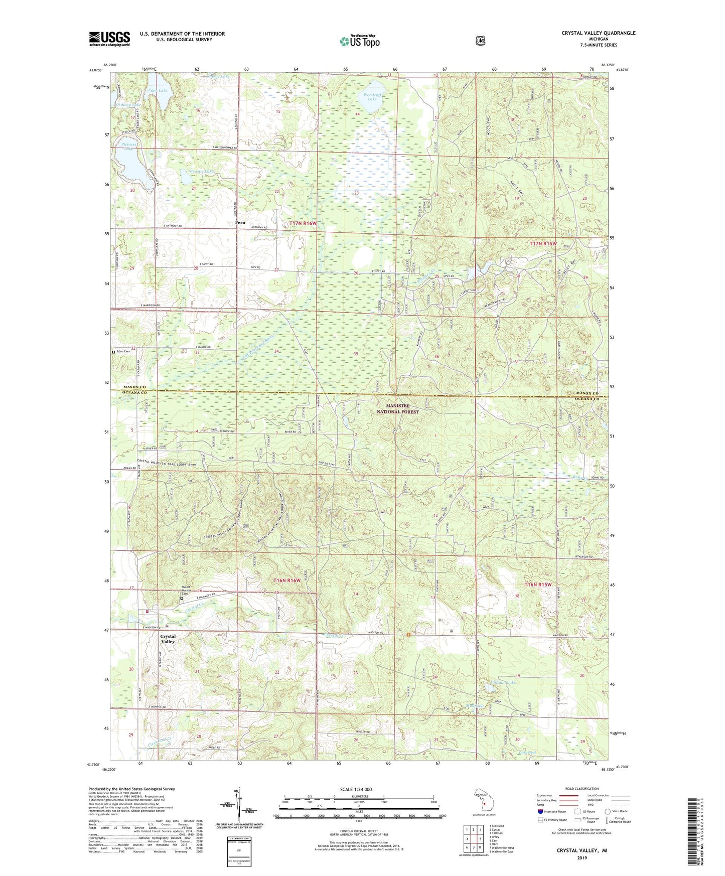
Crystal Valley Michigan US Topo Map
Couldn't load pickup availability
Also explore the Crystal Valley Forest Service Topo of this same quad for updated USFS data
2023 topographic map quadrangle Crystal Valley in the state of Michigan. Scale: 1:24000. Based on the newly updated USGS 7.5' US Topo map series, this map is in the following counties: Oceana, Mason. The map contains contour data, water features, and other items you are used to seeing on USGS maps, but also has updated roads and other features. This is the next generation of topographic maps. Printed on high-quality waterproof paper with UV fade-resistant inks.
Quads adjacent to this one:
West: Wiley
Northwest: Scottville
North: Custer
Northeast: Tallman
East: Carr
Southeast: Walkerville East
South: Walkerville West
Southwest: Hart
This map covers the same area as the classic USGS quad with code o43086g2.
Contains the following named places: Crystal Lookout Tower, Crystal Township Fire Department, Crystal Valley, Crystal Valley Methodist Church, Crystal Valley Post Office, Eden Lake, Eden Twonship Indian Cemetery, Elmwood School, Fern, Fern Post Office, Fern Station, Gilligan Lake, Kidder School, Mount Ulysses Cemetery, Mud Lake, Ordway Lake, Pleiness Lake, Sippy Oil Field, Stewart Lake, Township of Crystal, Township of Eden, Whiskey Creek, Woodruff Lake, Woods Trail, Yocks Pond