MyTopo
Woodbury Michigan US Topo Map
Couldn't load pickup availability
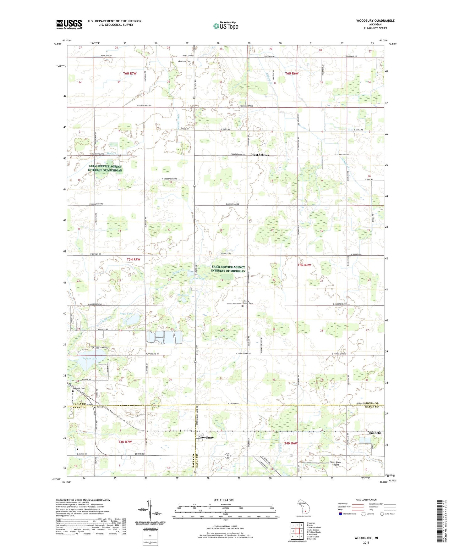
2019 topographic map quadrangle Woodbury in the state of Michigan. Scale: 1:24000. Based on the newly updated USGS 7.5' US Topo map series, this map is in the following counties: Ionia, Eaton, Barry. The map contains contour data, water features, and other items you are used to seeing on USGS maps, but also has updated roads and other features. This is the next generation of topographic maps. Printed on high-quality waterproof paper with UV fade-resistant inks.
Quads adjacent to this one:
West: Lake Odessa
Northwest: Saranac
North: Ionia
Northeast: Portland North
East: Portland South
Southeast: Hoytville
South: Saubee Lake
Southwest: Woodland
Contains the following named places: Alderman Cemetery, Augst Lake, Church of God, First Baptist Church of Sebewa, Lakeside Cemetery, Lakewood Church, Lakewood High School, Lakewood United Methodist Church, Little Lake, Meyers Cemetery, Mini Lake, Mud Lake, Peacock Ditch, Reeder Cemetery, Rosina Post Office, Saint Herman Orthodox Church, Sebewa Baptist Cemetery, Sebewa Center Church, Sebewa Church, Stony Acres Airport, Township of Sebewa, Tupper Creek, Tupper Lake, United Brethren Church, West Branch Knoll and Kneale Drain, West Sebewa, West Sebewa Church, West Sebewa Post Office, Woodbury, Woodbury Post Office, Woodbury Station, ZIP Code: 48849