MyTopo
Portland North Michigan US Topo Map
Couldn't load pickup availability
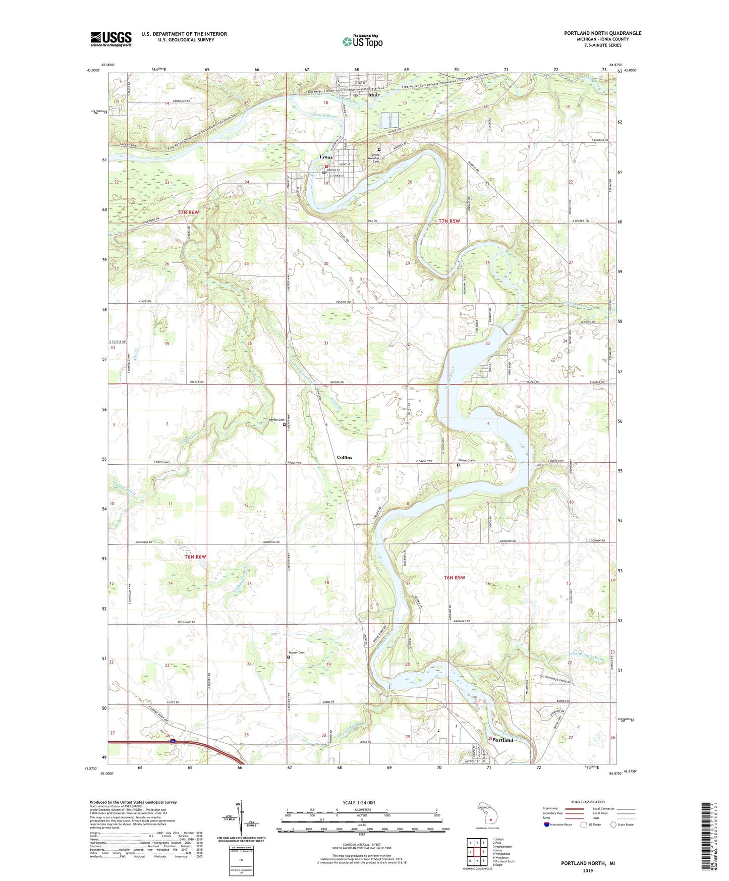
2023 topographic map quadrangle Portland North in the state of Michigan. Scale: 1:24000. Based on the newly updated USGS 7.5' US Topo map series, this map is in the following counties: Ionia. The map contains contour data, water features, and other items you are used to seeing on USGS maps, but also has updated roads and other features. This is the next generation of topographic maps. Printed on high-quality waterproof paper with UV fade-resistant inks.
Quads adjacent to this one:
West: Ionia
Northwest: Shiloh
North: Palo
Northeast: Hubbardston
East: Westphalia
Southeast: Eagle
South: Portland South
Southwest: Woodbury
This map covers the same area as the classic USGS quad with code o42084h8.
Contains the following named places: Ayers Branch, Balderson Drain, Bogue Flats Recreation Area, Brown Grave, Carbaugh Drain, Church of Christ Historical Marker, Collins, Collins Post Office, Collins Station, First Christian Church, Friend Brook, Goose Creek, Joe Tichvon Park, Keefer Cemetery, Kossuth Post Office, Libhart Creek, Little Libhart Creek, Lyons, Lyons - Muir Fire Department, Lyons Clinic Family Medicine, Lyons Post Office, Lyons Public Library, Lyons Station, Lyons Township Cemetery, Maple Post Office, Maple River, Mount Hope Church Portland, Muir, Muir Post Office, Muir Station, Portland Country Club, Portland High School, Portland Municipal Dam, Portland Station, Stoney Creek Pit, Township of Lyons, Township of Portland, Union Burial Ground, Village of Lyons, Village of Muir, Wagar Dam, Weber Dam, Westwood Elementary School, ZIP Code: 48851