MyTopo
Adrian Minnesota US Topo Map
Couldn't load pickup availability
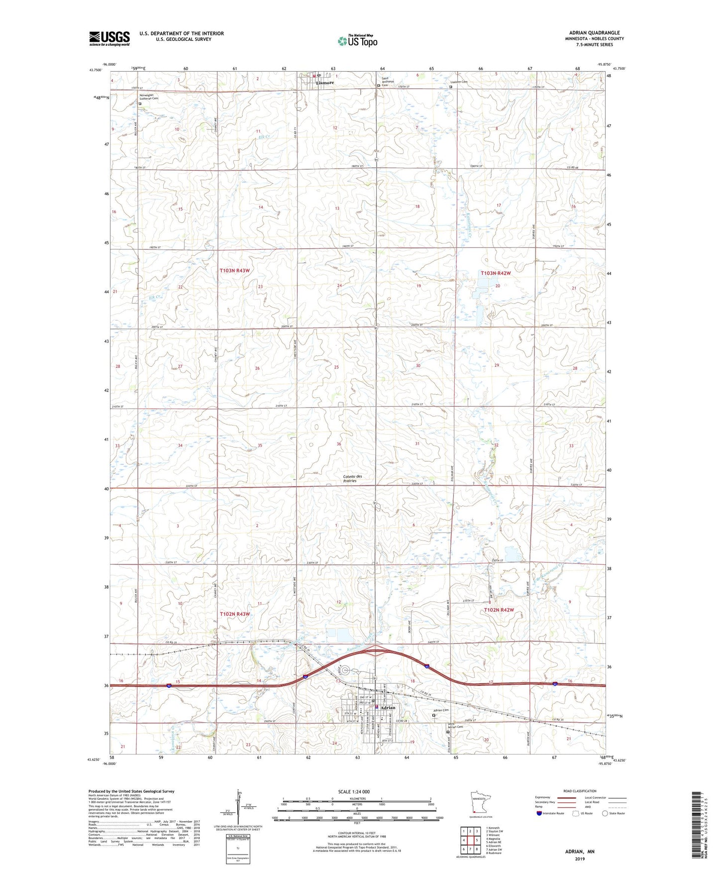
2022 topographic map quadrangle Adrian in the state of Minnesota. Scale: 1:24000. Based on the newly updated USGS 7.5' US Topo map series, this map is in the following counties: Nobles. The map contains contour data, water features, and other items you are used to seeing on USGS maps, but also has updated roads and other features. This is the next generation of topographic maps. Printed on high-quality waterproof paper with UV fade-resistant inks.
Quads adjacent to this one:
West: Magnolia
Northwest: Kenneth
North: Slayton SW
Northeast: Wilmont
East: Adrian NE
Southeast: Rushmore
South: Adrian SW
Southwest: Ellsworth
This map covers the same area as the classic USGS quad with code o43095f8.
Contains the following named places: Adrian, Adrian Care Center, Adrian Cemetery, Adrian City Hall, Adrian Country Club, Adrian Elementary School, Adrian High School, Adrian Library, Adrian Municipal Campground, Adrian Police Department, Adrian Post Office, Adrian Spring County Park, Adrian United Methodist Church, Adrian Volunteer Fire Department and Volunteer Ambulance Service, City of Adrian, City of Lismore, East Branch Kanaranzi Creek, First Baptist Church, First Presbyterian Church, Grove Park, Lismore, Lismore Cemetery, Lismore City Park, Lismore Fire Department, Lismore Post Office, Lower Park, Midway County Park, Norwegian Lutheran Cemetery, Prairie Winds Zoo, Saint Adrian Catholic Church, Saint Adrian Cemetery, Saint Anthony's Catholic Church, Saint Anthonys Cemetery, Township of Lismore, Township of Westside, Zion Lutheran Church