MyTopo
Alborn Minnesota US Topo Map
Couldn't load pickup availability
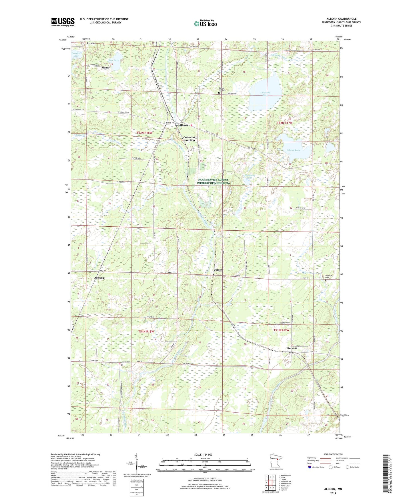
2019 topographic map quadrangle Alborn in the state of Minnesota. Scale: 1:24000. Based on the newly updated USGS 7.5' US Topo map series, this map is in the following counties: St. Louis. The map contains contour data, water features, and other items you are used to seeing on USGS maps, but also has updated roads and other features. This is the next generation of topographic maps. Printed on high-quality waterproof paper with UV fade-resistant inks.
Quads adjacent to this one:
West: Brookston NW
Northwest: Meadowlands
North: Payne
Northeast: Canyon
East: Independence
Southeast: Saginaw
South: Brookston
Southwest: Martin Lake
Contains the following named places: Alborn, Alborn Fire Department, Alborn Post Office, Alborn Station, Arlberg, Artichoke Lake, Bethlehem Church, Burnett, Burnett Post Office, Burnett Station, Coleraine Junction, Culver, Culver Cemetery, Culver Fire Department, Culver Post Office, Culver Station, Eier Lake, Indian Hill Cemetery, Industrial Cemetery, Industrial Church, Levindusky Lake, Maney, Prosit, Prosit Post Office, Prosit Station, Schelin Lake, Spruce Hill Cemetery, Township of Alborn, Township of Culver