MyTopo
Alden Minnesota US Topo Map
Couldn't load pickup availability
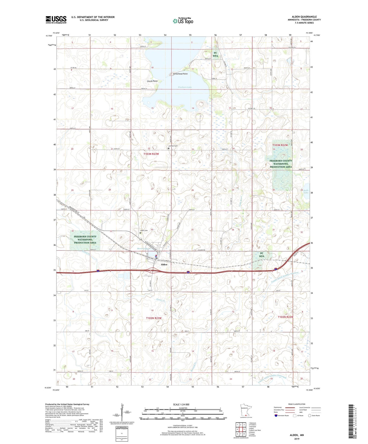
2019 topographic map quadrangle Alden in the state of Minnesota. Scale: 1:24000. Based on the newly updated USGS 7.5' US Topo map series, this map is in the following counties: Freeborn. The map contains contour data, water features, and other items you are used to seeing on USGS maps, but also has updated roads and other features. This is the next generation of topographic maps. Printed on high-quality waterproof paper with UV fade-resistant inks.
Quads adjacent to this one:
West: Wells
Northwest: Matawan
North: Freeborn
Northeast: Hartland
East: Albert Lea West
Southeast: Emmons
South: Conger
Southwest: Kiester
Contains the following named places: Alden, Alden Cemetery, Alden Fire Department, Alden Museum, Alden Police Department, Alden Post Office, Alden Public School, Arrowhead Point, Arrowhead Point County Park, Buckeye School, Carlston Cemetery, Chicks Point, City of Alden, Freeborn Lake, Halls Lake, Heideman School, Morin Lake, North Park, Oakview Golf Course, Pioneer School, Redeemer Lutheran Church, Township of Alden, Township of Carlston, United Methodist Church, ZIP Code: 56009