MyTopo
Kiester Minnesota US Topo Map
Couldn't load pickup availability
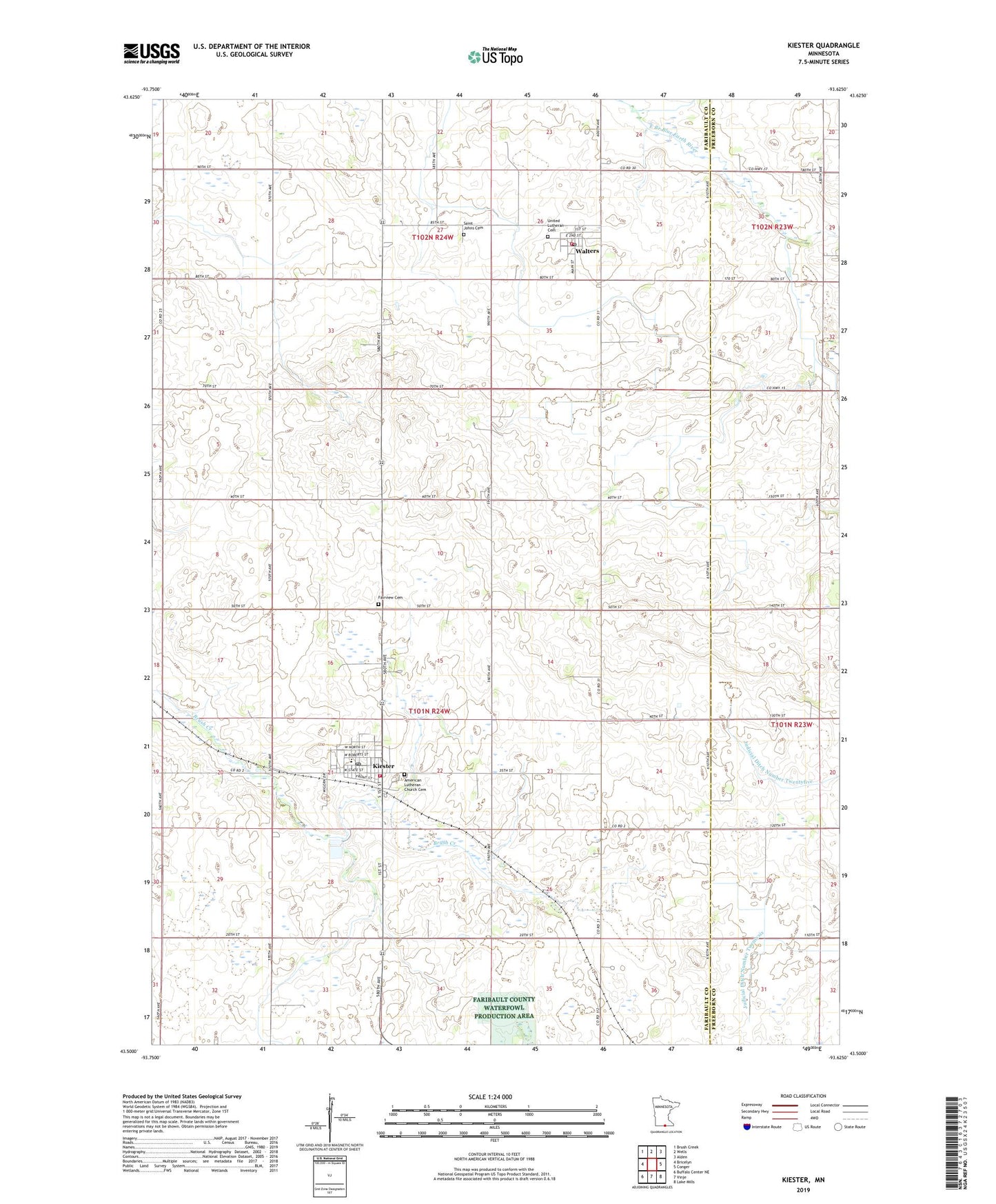
2022 topographic map quadrangle Kiester in the state of Minnesota. Scale: 1:24000. Based on the newly updated USGS 7.5' US Topo map series, this map is in the following counties: Faribault, Freeborn. The map contains contour data, water features, and other items you are used to seeing on USGS maps, but also has updated roads and other features. This is the next generation of topographic maps. Printed on high-quality waterproof paper with UV fade-resistant inks.
Quads adjacent to this one:
West: Bricelyn
Northwest: Brush Creek
North: Wells
Northeast: Alden
East: Conger
Southeast: Lake Mills
South: Vinje
Southwest: Buffalo Center NE
This map covers the same area as the classic USGS quad with code o43093e6.
Contains the following named places: American Lutheran Church Cemetery, City of Kiester, City of Walters, Fairview Cemetery, Gospel Church, Grace United Methodist Church, Kiester, Kiester Ambulance, Kiester City Hall, Kiester Medical Center, Kiester Middle School, Kiester Post Office, Kiester Volunteer Fire Department, Our Saviour's Lutheran Church, Passer Landing Strip, Saint Johns Cemetery, Township of Kiester, United Brethren Cemetery, United Lutheran Cemetery, Walters, Walters Post Office, Walters Volunteer Fire Department, ZIP Code: 56051