MyTopo
Hartland Minnesota US Topo Map
Couldn't load pickup availability
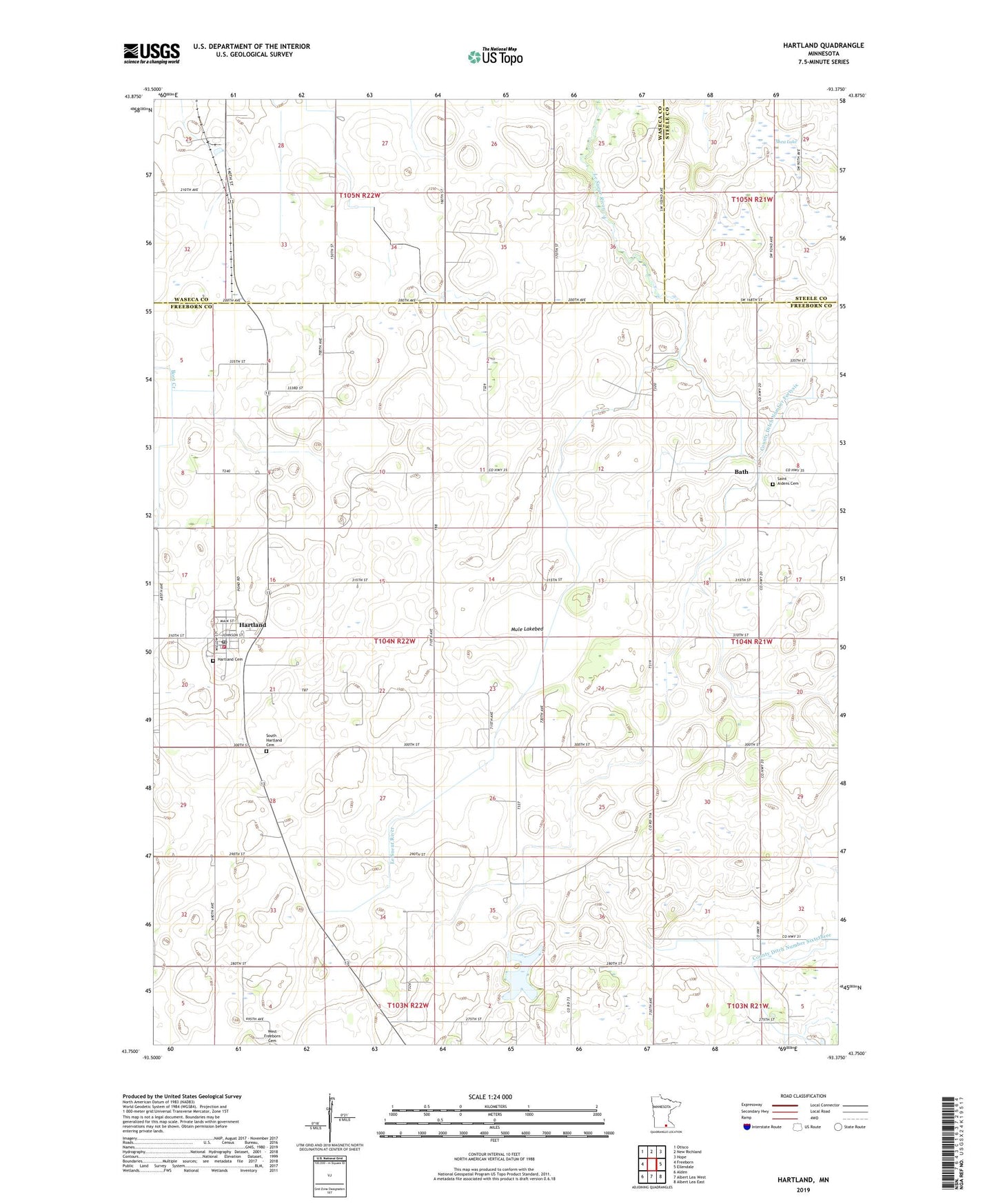
2022 topographic map quadrangle Hartland in the state of Minnesota. Scale: 1:24000. Based on the newly updated USGS 7.5' US Topo map series, this map is in the following counties: Freeborn, Waseca, Steele. The map contains contour data, water features, and other items you are used to seeing on USGS maps, but also has updated roads and other features. This is the next generation of topographic maps. Printed on high-quality waterproof paper with UV fade-resistant inks.
Quads adjacent to this one:
West: Freeborn
Northwest: Otisco
North: New Richland
Northeast: Hope
East: Ellendale
Southeast: Albert Lea East
South: Albert Lea West
Southwest: Alden
This map covers the same area as the classic USGS quad with code o43093g4.
Contains the following named places: Bath, Bath Post Office, City of Hartland, County Ditch Number Twentyeight, Cross of Glory Lutheran Church, Hartland, Hartland Cemetery, Hartland City Hall, Hartland Fire Department, Hartland Post Office, Heartland Evangelical Lutheran Church, Judicial Ditch Number Six, Mule Lakebed, Saint Aidens Cemetery, Shea Lake, South Hartland Cemetery, Township of Hartland, ZIP Code: 56042