MyTopo
Conger Minnesota US Topo Map
Couldn't load pickup availability
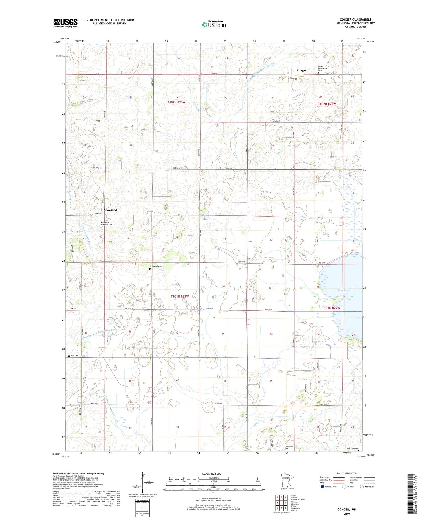
2022 topographic map quadrangle Conger in the state of Minnesota. Scale: 1:24000. Based on the newly updated USGS 7.5' US Topo map series, this map is in the following counties: Freeborn. The map contains contour data, water features, and other items you are used to seeing on USGS maps, but also has updated roads and other features. This is the next generation of topographic maps. Printed on high-quality waterproof paper with UV fade-resistant inks.
Quads adjacent to this one:
West: Kiester
Northwest: Wells
North: Alden
Northeast: Albert Lea West
East: Emmons
Southeast: Bristol
South: Lake Mills
Southwest: Vinje
This map covers the same area as the classic USGS quad with code o43093e5.
Contains the following named places: Babbitt School, Bear Lake, Bidne School, City of Conger, Conger, Conger City Hall, Conger Community Cemetery, Conger Fire Department, Conger Post Office, County Ditch Number Five, County Ditch Number Fortyeight, County Ditch Number Twentythree, Judicial Ditch Number Twentyfive, Judicial Ditch Number Twentysix, Laugen School, Mansfield, Mansfield Church, Mansfield Lutheran Cemetery, Mansfield Post Office, Oak Lawn Cemetery, Opdahl School, Saint Paul Lutheran Church, Schmidt School, Schnieder Cemetery, State Line School, Steward Creek, Township of Mansfield, Zion Cemetery, Zion Church, ZIP Codes: 56020, 56029