MyTopo
Anderson Lake Minnesota US Topo Map
Couldn't load pickup availability
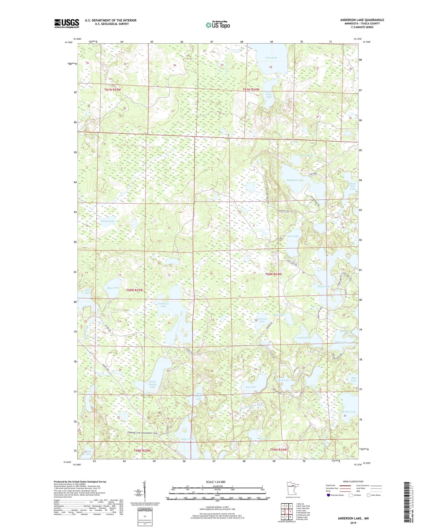
2019 topographic map quadrangle Anderson Lake in the state of Minnesota. Scale: 1:24000. Based on the newly updated USGS 7.5' US Topo map series, this map is in the following counties: Itasca. The map contains contour data, water features, and other items you are used to seeing on USGS maps, but also has updated roads and other features. This is the next generation of topographic maps. Printed on high-quality waterproof paper with UV fade-resistant inks.
Quads adjacent to this one:
West: Coon Lake
Northwest: Effie SE
North: Deer Lake West
Northeast: Deer Lake East
East: Horsehead Lake
Southeast: Hartley Lake
South: Balsam Lake
Southwest: Clubhouse Lake
Contains the following named places: Anderson Lake, Ann Lake, Antler Lake, Bartlet Lake, Bass Lake, Beaver Lake, Blind Pete Lake, Bloom Lake, Brush Shanty Lake, Coon Lake, Crescent Lake, Finley Lake, Gale Lake, Kelly Lake, Lake Alice, Link Lake, Link Lake Lookout Tower, Little Antler Lake, Little Coon Lake, Long Lake, Lost Lake, O'Donnell Lake, Old Scenic Church, Owen Lake, Raddison Lake, Rainbow Lake, Rat Lake