MyTopo
Horsehead Lake Minnesota US Topo Map
Couldn't load pickup availability
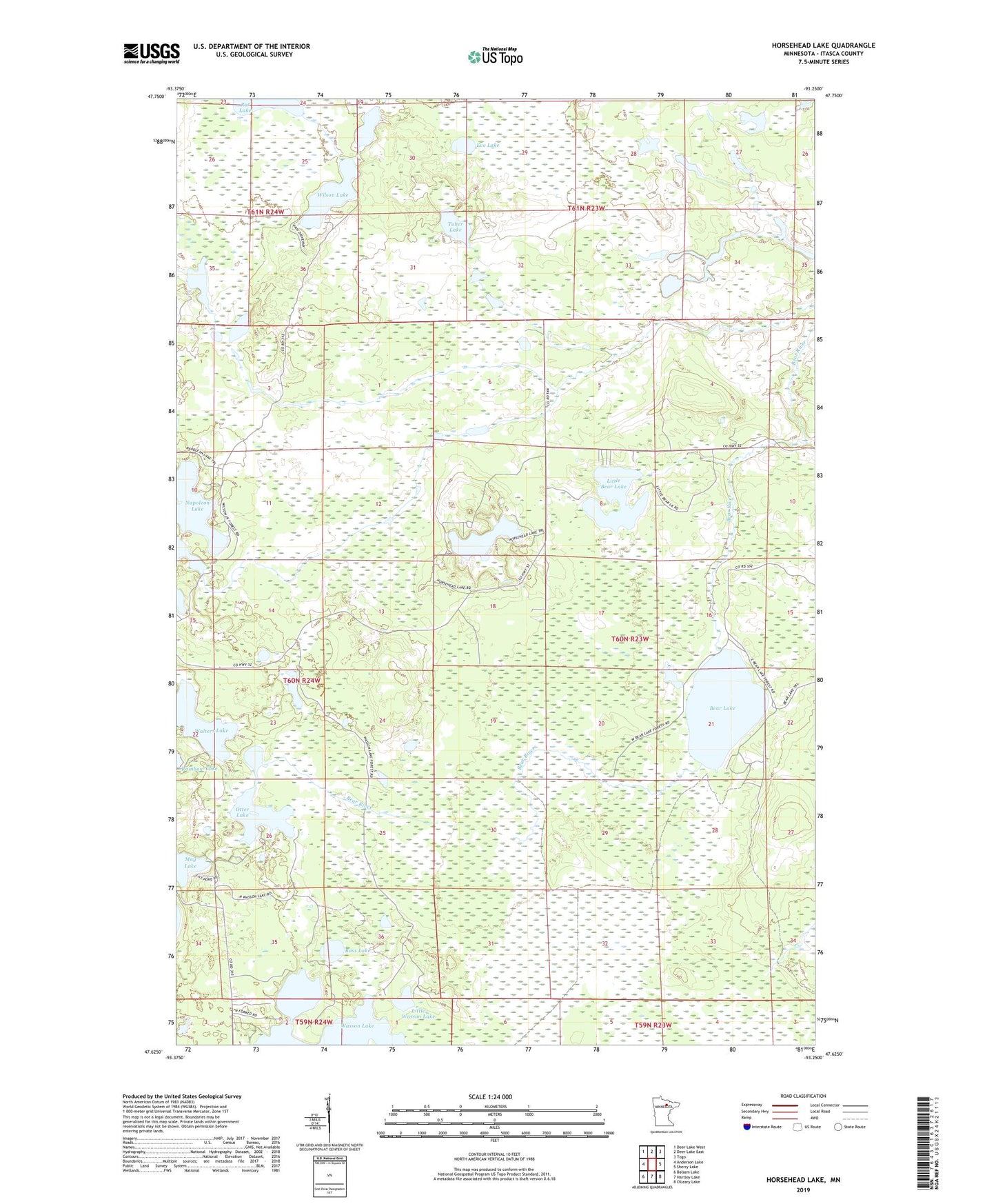
2022 topographic map quadrangle Horsehead Lake in the state of Minnesota. Scale: 1:24000. Based on the newly updated USGS 7.5' US Topo map series, this map is in the following counties: Itasca. The map contains contour data, water features, and other items you are used to seeing on USGS maps, but also has updated roads and other features. This is the next generation of topographic maps. Printed on high-quality waterproof paper with UV fade-resistant inks.
Quads adjacent to this one:
West: Anderson Lake
Northwest: Deer Lake West
North: Deer Lake East
Northeast: Togo
East: Sherry Lake
South: Hartley Lake
Southwest: Balsam Lake
This map covers the same area as the classic USGS quad with code o47093f3.
Contains the following named places: Bass Lake, Bear Lake, Eve Lake, Klingenpiel Lake, Little Bear Lake, Little Wasson Lake, May Lake, Napoleon Lake, Otter Lake, Pickle Lake, Rat Lake, Tuber Lake, Unorganized Territory of Northeast Itasca, Walters Lake, Wasson Lake Trail, Wilson Lake, Wilson Lake Trail