MyTopo
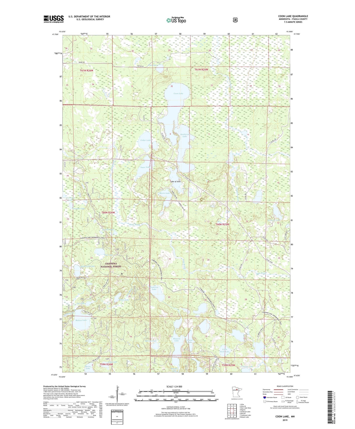
Coon Lake Minnesota US Topo Map
Couldn't load pickup availability
Also explore the Coon Lake Forest Service Topo of this same quad for updated USFS data
2022 topographic map quadrangle Coon Lake in the state of Minnesota. Scale: 1:24000. Based on the newly updated USGS 7.5' US Topo map series, this map is in the following counties: Itasca. The map contains contour data, water features, and other items you are used to seeing on USGS maps, but also has updated roads and other features. This is the next generation of topographic maps. Printed on high-quality waterproof paper with UV fade-resistant inks.
Quads adjacent to this one:
West: Bigfork
Northwest: Effie
North: Effie SE
Northeast: Deer Lake West
East: Anderson Lake
Southeast: Balsam Lake
South: Clubhouse Lake
Southwest: Marcell
This map covers the same area as the classic USGS quad with code o47093f5.
Contains the following named places: Batson Lake, Cad Lake, Cameron Lake, Cameron Lake Trail, Canoe Lake, Cedar Lake, Coon Lake, Erickson Lake, Fox Farm Lake, Gorman Lake, Herron Lake, Homestead Lake, Isaac Lake, Joe Fell Lake, Joel Lake, Johnson Creek, La Barge Lake, Lake of Isles, Little Neck Lake, Marie Lake, McDonald Lake, Pine Lake, Sandwick Lake, Scenic Lookout Tower, Scenic State Park, Slauson Lake, State Park Headquarters, Tye Lake, Willis Lake, Woodland Terrace Mobile Home Park, ZIP Code: 56628