MyTopo
Artichoke Lake NW Minnesota US Topo Map
Couldn't load pickup availability
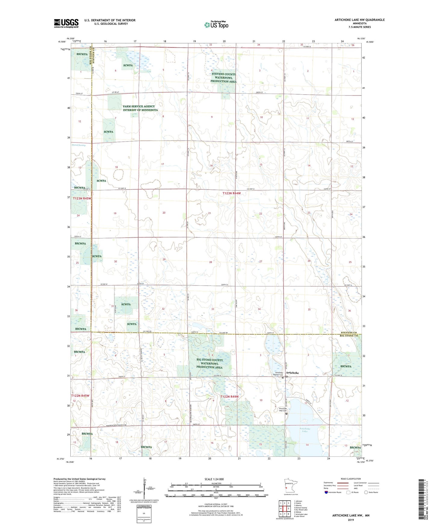
2022 topographic map quadrangle Artichoke Lake NW in the state of Minnesota. Scale: 1:24000. Based on the newly updated USGS 7.5' US Topo map series, this map is in the following counties: Stevens, Big Stone. The map contains contour data, water features, and other items you are used to seeing on USGS maps, but also has updated roads and other features. This is the next generation of topographic maps. Printed on high-quality waterproof paper with UV fade-resistant inks.
Quads adjacent to this one:
West: Dismal Swamp
Northwest: Johnson
North: Chokio
Northeast: Alberta
East: Dry Wood Lake
Southeast: Lake Oliver
South: Artichoke Lake
Southwest: Odessa
This map covers the same area as the classic USGS quad with code o45096d2.
Contains the following named places: Artichoke, Artichoke Baptist Cemetery, Artichoke Baptist Church, Artichoke Lake Cemetery, Artichoke Lake Church, Artichoke Lake Post Office, Chokio State Wildlife Management Area, County Ditch Number Twentyone, County Ditch Number Twentytwo, Grossman Slough, Robertson State Wildlife Management Area, School Number 142, Township of Stevens