MyTopo
Odessa Minnesota US Topo Map
Couldn't load pickup availability
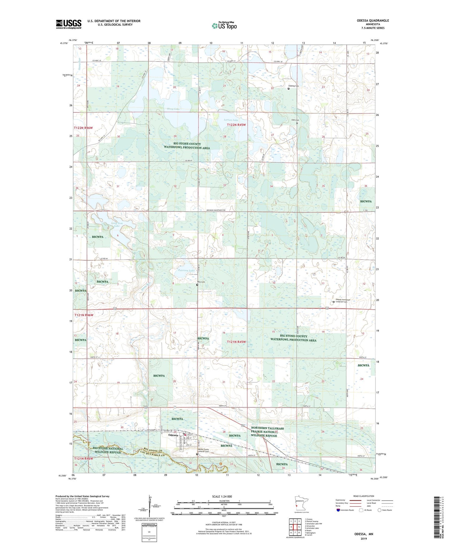
2022 topographic map quadrangle Odessa in the state of Minnesota. Scale: 1:24000. Based on the newly updated USGS 7.5' US Topo map series, this map is in the following counties: Big Stone, Lac qui Parle. The map contains contour data, water features, and other items you are used to seeing on USGS maps, but also has updated roads and other features. This is the next generation of topographic maps. Printed on high-quality waterproof paper with UV fade-resistant inks.
Quads adjacent to this one:
West: Ortonville
Northwest: Clinton
North: Dismal Swamp
Northeast: Artichoke Lake NW
East: Artichoke Lake
Southeast: Correll
South: Bellingham
Southwest: Rosen
This map covers the same area as the classic USGS quad with code o45096c3.
Contains the following named places: City of Odessa, Eids Cemetery, Eids Church, Eidskog Cemetery, Eidskog Church, Horseshoe Lake, Immanuel Church, Larson Lake, Lindquist State Wildlife Management Area, Long Tom Lake, Long Tom Lake Dam, Odessa, Odessa Fire Department, Odessa Immanuel Lutheran Cemetery, Odessa Post Office, Odessa Trinity Lutheran Cemetery, Otrey Lake, Otrey State Wildlife Management Area, Peterson Lake, Prairie State Wildlife Management Area, Rest Cemetery, School Number 47, School Number 48, Stony Run, Township of Odessa, Township of Otrey, Trinity Lutheran Church, Victor State Wildlife Management Area