
MyTopo
Atwater Minnesota US Topo Map
Couldn't load pickup availability
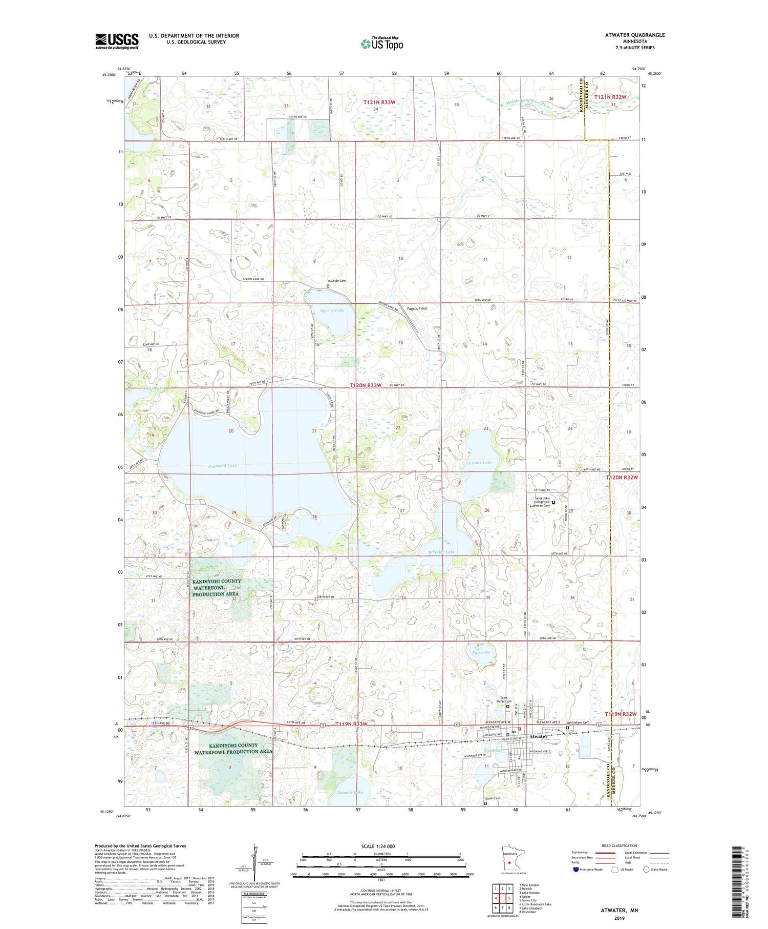
2019 topographic map quadrangle Atwater in the state of Minnesota. Scale: 1:24000. Based on the newly updated USGS 7.5' US Topo map series, this map is in the following counties: Kandiyohi, Meeker. The map contains contour data, water features, and other items you are used to seeing on USGS maps, but also has updated roads and other features. This is the next generation of topographic maps. Printed on high-quality waterproof paper with UV fade-resistant inks.
Quads adjacent to this one:
West: Spicer
Northwest: New London
North: Hawick
Northeast: Lake Koronis
East: Grove City
Southeast: Rosendale
South: Lake Elizabeth
Southwest: Little Kandiyohi Lake
Contains the following named places: Affiliated Community Medical Center, Atwater, Atwater Cosmos Grove City School, Atwater Fire Department, Atwater Library, Atwater Police Department, Atwater Post Office, Bethlehem Cemetery, Bethlehem Lutheran Church, Centennial Park, City of Atwater, County Park Number Three, Diamond Lake, Diamond Lake Dam, Gordy Johnson Little League Field, Harrison Church, Homer Bach Softball Field, Hubbard Lake, Immanuel Lutheran Church, Island Pine Golf Club, Jesse Lake, Oakside Cemetery, Pagel's Field, Pay Lake, Saint John Evangelical Lutheran Cemetery, Saint John Lutheran Church, Saint Johns School, Saint Marys Cemetery, Schultz Lake, Sperry Lake, Summit Lake, Tadd Lake, Taits Lake, Township of Harrison, Union Cemetery, United Methodist Church, Upper Lake, Wheeler Lake, ZIP Code: 56209


