MyTopo
Lake Koronis Minnesota US Topo Map
Couldn't load pickup availability
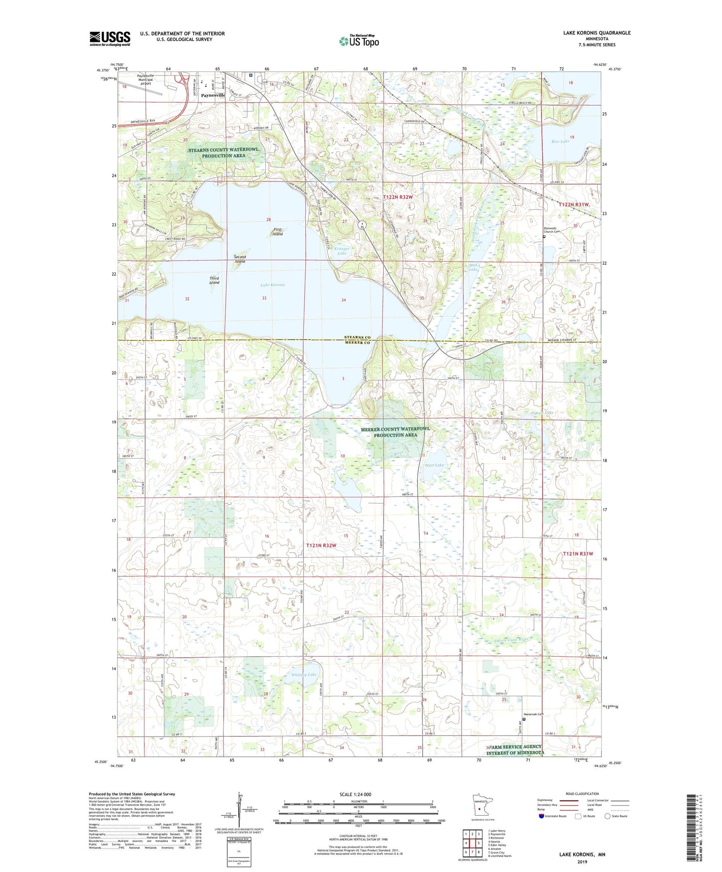
2022 topographic map quadrangle Lake Koronis in the state of Minnesota. Scale: 1:24000. Based on the newly updated USGS 7.5' US Topo map series, this map is in the following counties: Meeker, Stearns. The map contains contour data, water features, and other items you are used to seeing on USGS maps, but also has updated roads and other features. This is the next generation of topographic maps. Printed on high-quality waterproof paper with UV fade-resistant inks.
Quads adjacent to this one:
West: Hawick
Northwest: Lake Henry
North: Paynesville
Northeast: Richmond
East: Eden Valley
Southeast: Litchfield North
South: Grove City
Southwest: Atwater
This map covers the same area as the classic USGS quad with code o45094c6.
Contains the following named places: Assembly of God Church, Centra Care Paynesville Hospital, Ebenezer Church, Ebenezer Church Cemetery, Empire Valley Airport, First Island, Integrated Health Center, Koronis Hills Golf Club, Krueger Lake, Lake Emma, Lake Koronis, Lake Koronis Assembly Ground, Lake Koronis Regional Park Campground, Lake Koronis Rest Area, Manannah Cemetery, Mud Lake, Paynesville High School, Paynesville Medical Clinic, Paynesville Middle School, Paynesville Municipal Airport, Pigeon Lake, Sandy Point Park, School Number 1088, School Number 1089, School Number 1090, School Number 1096, School Number 2044, Second Island, South Koronis Park, Third Island, Township of Paynesville, Township of Union Grove, West Lake, Whitney Lake