MyTopo
New London Minnesota US Topo Map
Couldn't load pickup availability
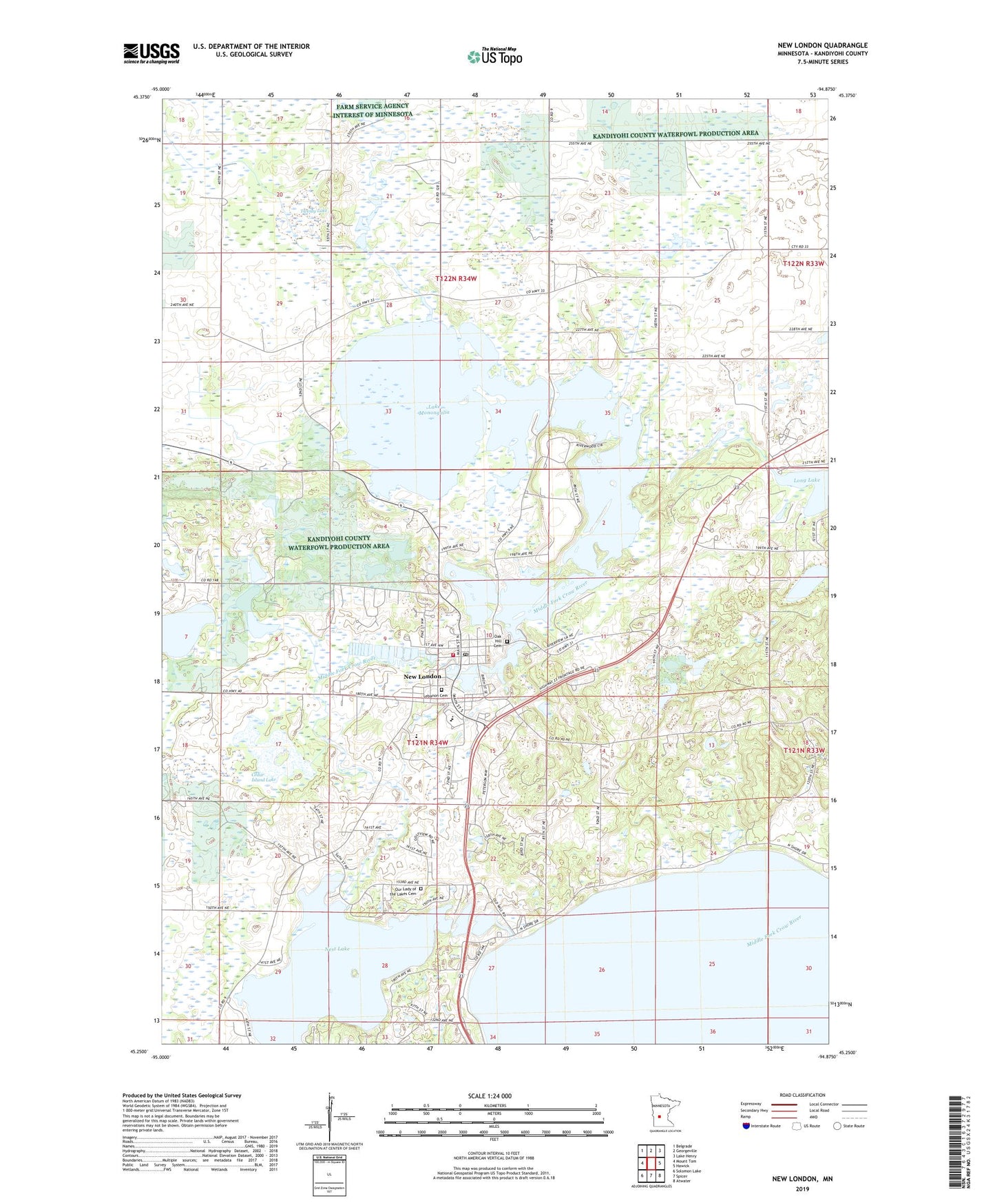
2022 topographic map quadrangle New London in the state of Minnesota. Scale: 1:24000. Based on the newly updated USGS 7.5' US Topo map series, this map is in the following counties: Kandiyohi. The map contains contour data, water features, and other items you are used to seeing on USGS maps, but also has updated roads and other features. This is the next generation of topographic maps. Printed on high-quality waterproof paper with UV fade-resistant inks.
Quads adjacent to this one:
West: Mount Tom
Northwest: Belgrade
North: Georgeville
Northeast: Lake Henry
East: Hawick
Southeast: Atwater
South: Spicer
Southwest: Solomon Lake
This map covers the same area as the classic USGS quad with code o45094c8.
Contains the following named places: Affiliated Community Medical Center, Bear Lake, Burbank State Wildlife Management Area, Cedar Island Lake, City of New London, Evangelical Covenant Church, Glen Oaks Care Center, Grace Church, Green Lake, Harbor Foursquare Gospel Church, Hide-Away Campground, Hope Presbyterian Church, Lake Eight, Lake Monongalia, Lebanon Cemetery, Little Crow Country Club, Long Lake, Long Lake Dam, Mill Pond, Nest Lake, Nest Lake Dam, New London, New London Ambulance Service, New London Dam, New London Fire Department, New London Library, New London National Fish Hatchery, New London Post Office, New London Spicer High School, Oak Hill Cemetery, Our Lady of the Lakes Cemetery, Peace Lutheran Church, Ringo-Nest State Wildlife Management Park a, Seventh-Day Adventist Church, Shepherd of the Hills Lutheran Church, Shoemaker Lake, Township of Burbank, Township of New London, Twenty Lake, ZIP Code: 56273