MyTopo
Minnewawa Minnesota US Topo Map
Couldn't load pickup availability
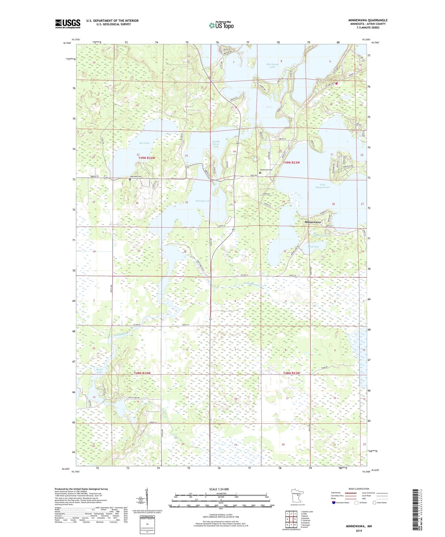
2022 topographic map quadrangle Minnewawa in the state of Minnesota. Scale: 1:24000. Based on the newly updated USGS 7.5' US Topo map series, this map is in the following counties: Aitkin. The map contains contour data, water features, and other items you are used to seeing on USGS maps, but also has updated roads and other features. This is the next generation of topographic maps. Printed on high-quality waterproof paper with UV fade-resistant inks.
Quads adjacent to this one:
West: Palisade
Northwest: Sanders Lake
North: Libby
Northeast: Balsam
East: Tamarack
Southeast: Lawler
South: McGregor
Southwest: Kimberly
This map covers the same area as the classic USGS quad with code o46093f3.
Contains the following named places: Tell Him I Blame Him for the Children We Have Lost... Aish-Ke-Vo-Go-Zhe Historical Marker, 55760, Davis Lake, Dollar Lake, Flowage Lake, Grace Church, Lake Minnewawa, Lakeview Cemetery, McGregor Volunteer Fire Department Station 2, Minnesota Department of Natural Resources Sandy Lake Field Station, Minnewawa, Minnewawa Creek, Mud Lake, Rat Lake, Sandy River Lake, Savanna Fairways Golf Club, Shamrock Cemetery, Steamboat Lake, Township of McGregor, Township of Shamrock