MyTopo
Bear River Minnesota US Topo Map
Couldn't load pickup availability
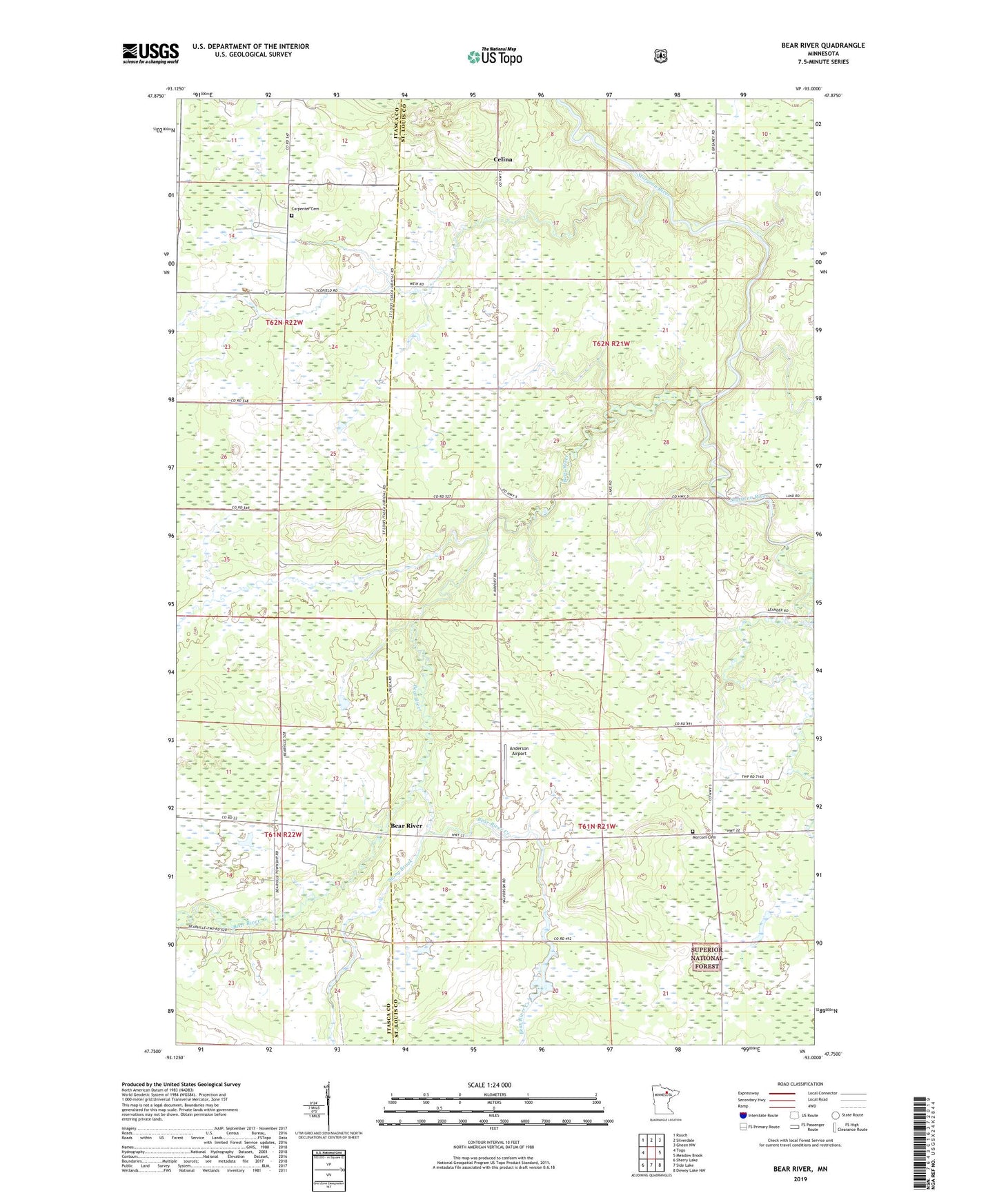
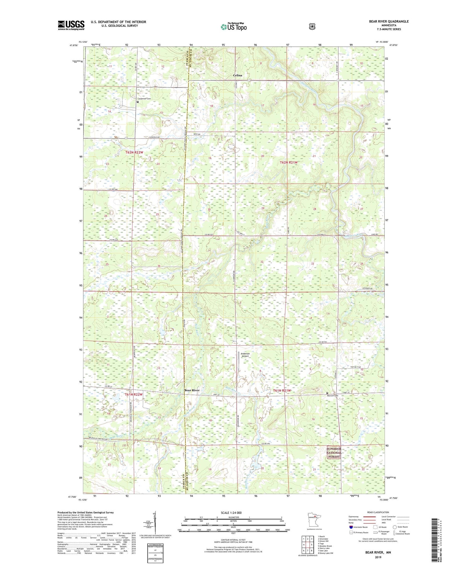
2019 topographic map quadrangle Bear River in the state of Minnesota. Scale: 1:24000. Based on the newly updated USGS 7.5' US Topo map series, this map is in the following counties: St. Louis, Itasca. The map contains contour data, water features, and other items you are used to seeing on USGS maps, but also has updated roads and other features. This is the next generation of topographic maps. Printed on high-quality waterproof paper with UV fade-resistant inks.
Quads adjacent to this one:
West: Togo
Northwest: Rauch
North: Silverdale
Northeast: Gheen NW
East: Meadow Brook
Southeast: Dewey Lake NW
South: Side Lake
Southwest: Sherry Lake
Contains the following named places: Anderson Airport, Bear River, Bear River Creek, Bear RIver Post Office, Beat River School, Carpenter Cemetery, Celina, Celina Post Office, Morcom Cemetery, Sand Creek, Stony Brook, Sturgeon River Post Office, Township of Morcom, Unorganized Territory of Sturgeon River