MyTopo
Sherry Lake Minnesota US Topo Map
Couldn't load pickup availability
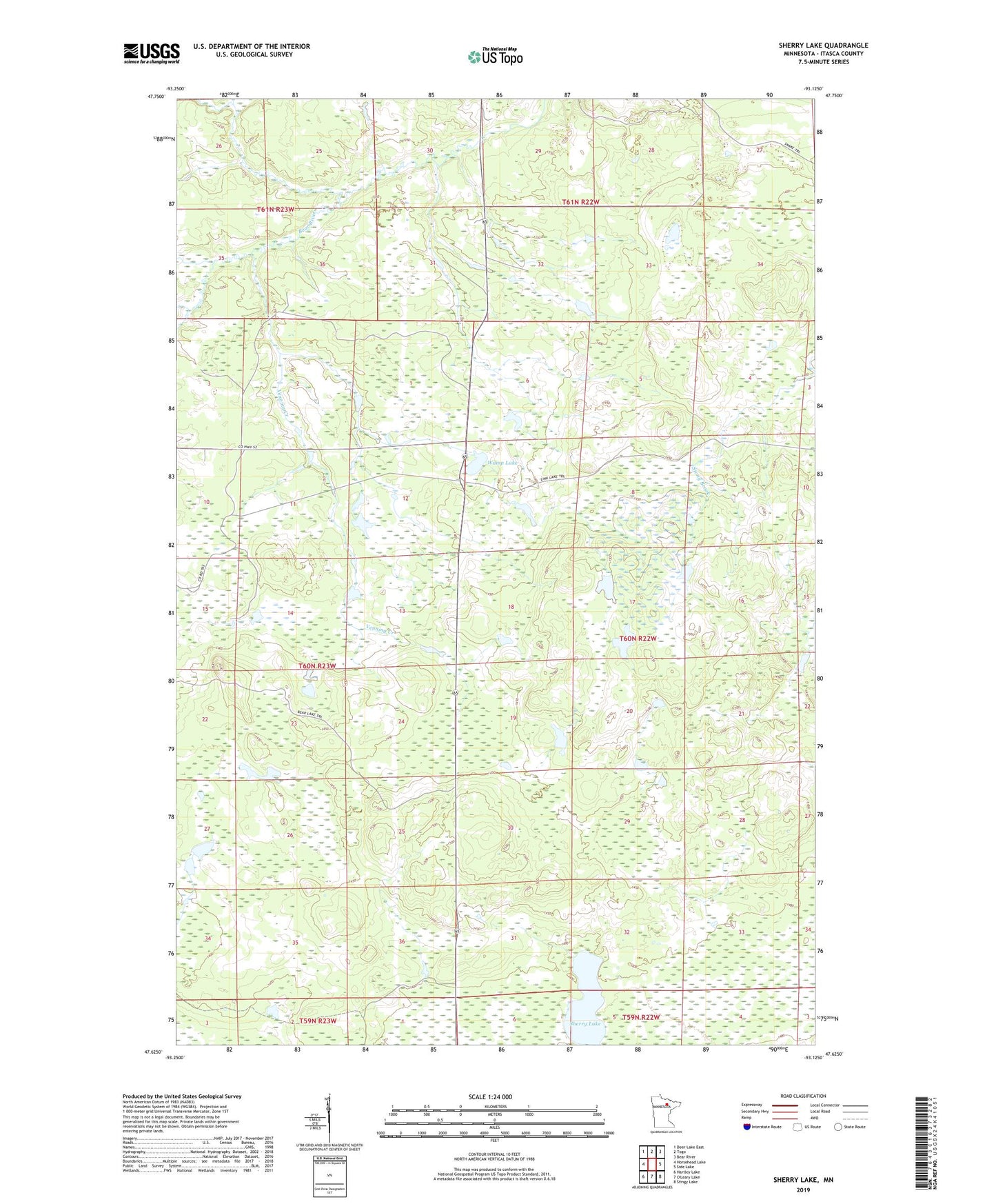
2022 topographic map quadrangle Sherry Lake in the state of Minnesota. Scale: 1:24000. Based on the newly updated USGS 7.5' US Topo map series, this map is in the following counties: Itasca. The map contains contour data, water features, and other items you are used to seeing on USGS maps, but also has updated roads and other features. This is the next generation of topographic maps. Printed on high-quality waterproof paper with UV fade-resistant inks.
Quads adjacent to this one:
West: Horsehead Lake
Northwest: Deer Lake East
North: Togo
Northeast: Bear River
East: Side Lake
Southeast: Stingy Lake
Southwest: Hartley Lake
This map covers the same area as the classic USGS quad with code o47093f2.
Contains the following named places: George Washington State Forest, Louis Peloquin Wildlife Impoundment Dam, Louis Peloquin Wildlife Impoundment Reservoir, Sherry Lake, Stony Ridge Lookout Tower, Township of Bearville, Venning Creek, Wamp Lake