MyTopo
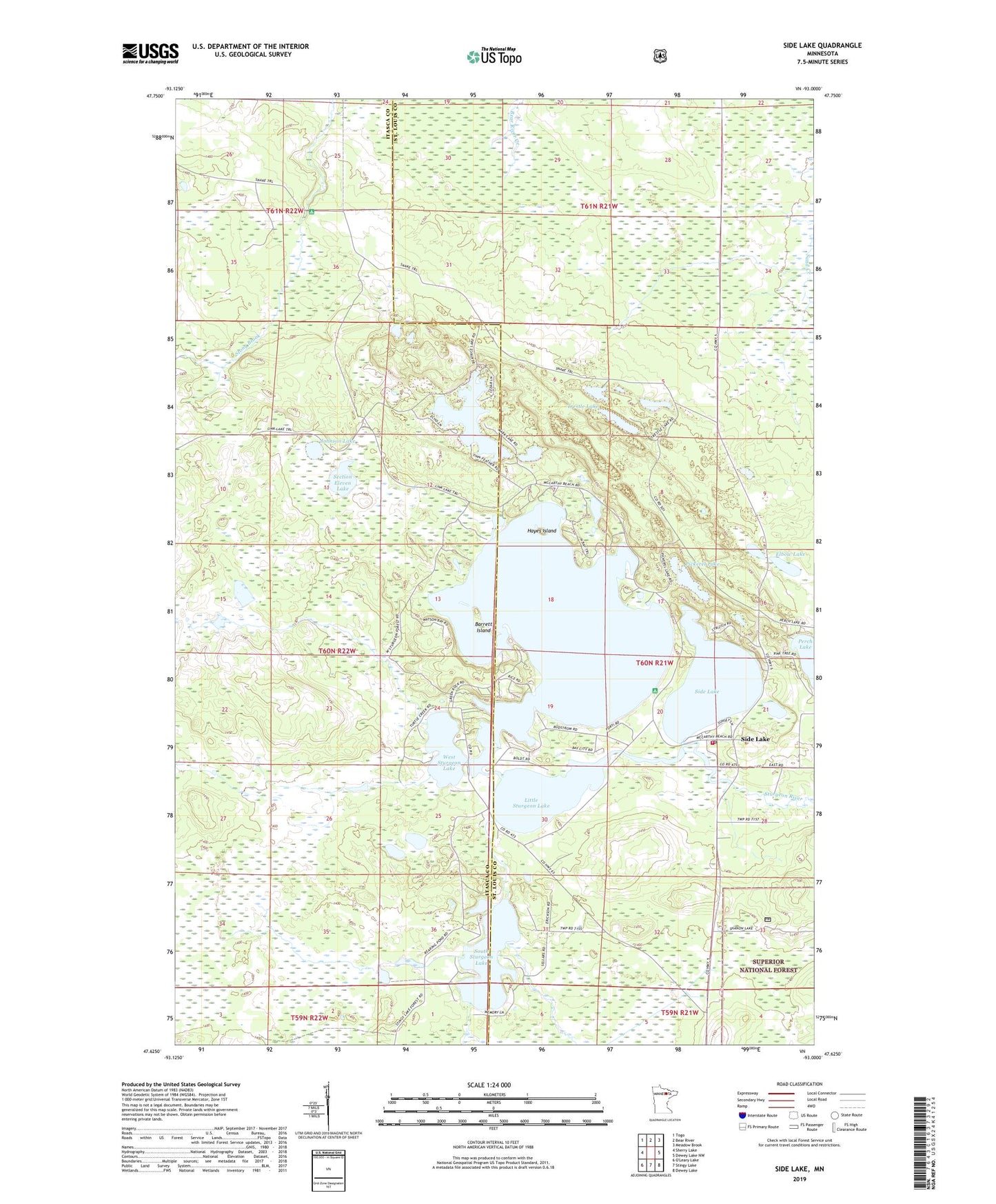
Side Lake Minnesota US Topo Map
Couldn't load pickup availability
Also explore the Side Lake Forest Service Topo of this same quad for updated USFS data
2022 topographic map quadrangle Side Lake in the state of Minnesota. Scale: 1:24000. Based on the newly updated USGS 7.5' US Topo map series, this map is in the following counties: St. Louis, Itasca. The map contains contour data, water features, and other items you are used to seeing on USGS maps, but also has updated roads and other features. This is the next generation of topographic maps. Printed on high-quality waterproof paper with UV fade-resistant inks.
Quads adjacent to this one:
West: Sherry Lake
Northwest: Togo
North: Bear River
Northeast: Meadow Brook
East: Dewey Lake NW
Southeast: Dewey Lake
South: Stingy Lake
This map covers the same area as the classic USGS quad with code o47093f1.
Contains the following named places: Barrett Island, Beatrice Lake, Chapel of the Pines, Christenson Point Seaplane Base, Elbow Lake, French Fire Department and Emergency Medical Services, Hayes Island, Johnson Lake, Lakeview Chapel, Link Lake Trail, Little Sturgeon Lake, McCarthy Beach State Park, Origin of McCarthy Beach Geological Marker, Pickerel Lake, Pine Beach Resort and Campground, Section Eleven Lake, Side Lake, Side Lake Post Office, Sixberrys Landing Seaplane Base, Snake Trail, South Sturgeon Lake, Stingy Lake Trail, Stony Brook Campground, Sturgeon Lake, Sturgeon Lake Dam, Sturgeon Lake Mission, Trestle Lake, West Sturgeon Lake, ZIP Code: 55781